iHARP hosts monthly Talk Tuesdays at 4p(est) that cover a variety of areas related to iHARP. Below are video recordings from previous talks.
Note: Talk Tuesdays will resume in Spring 2026
Click here to check out other talks given by iHARP Members.
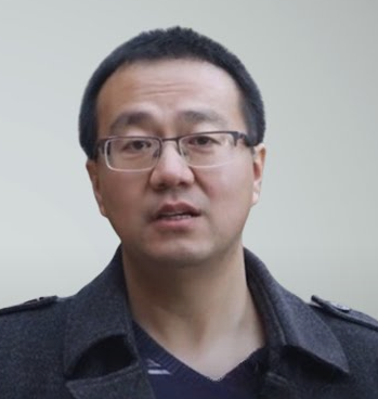
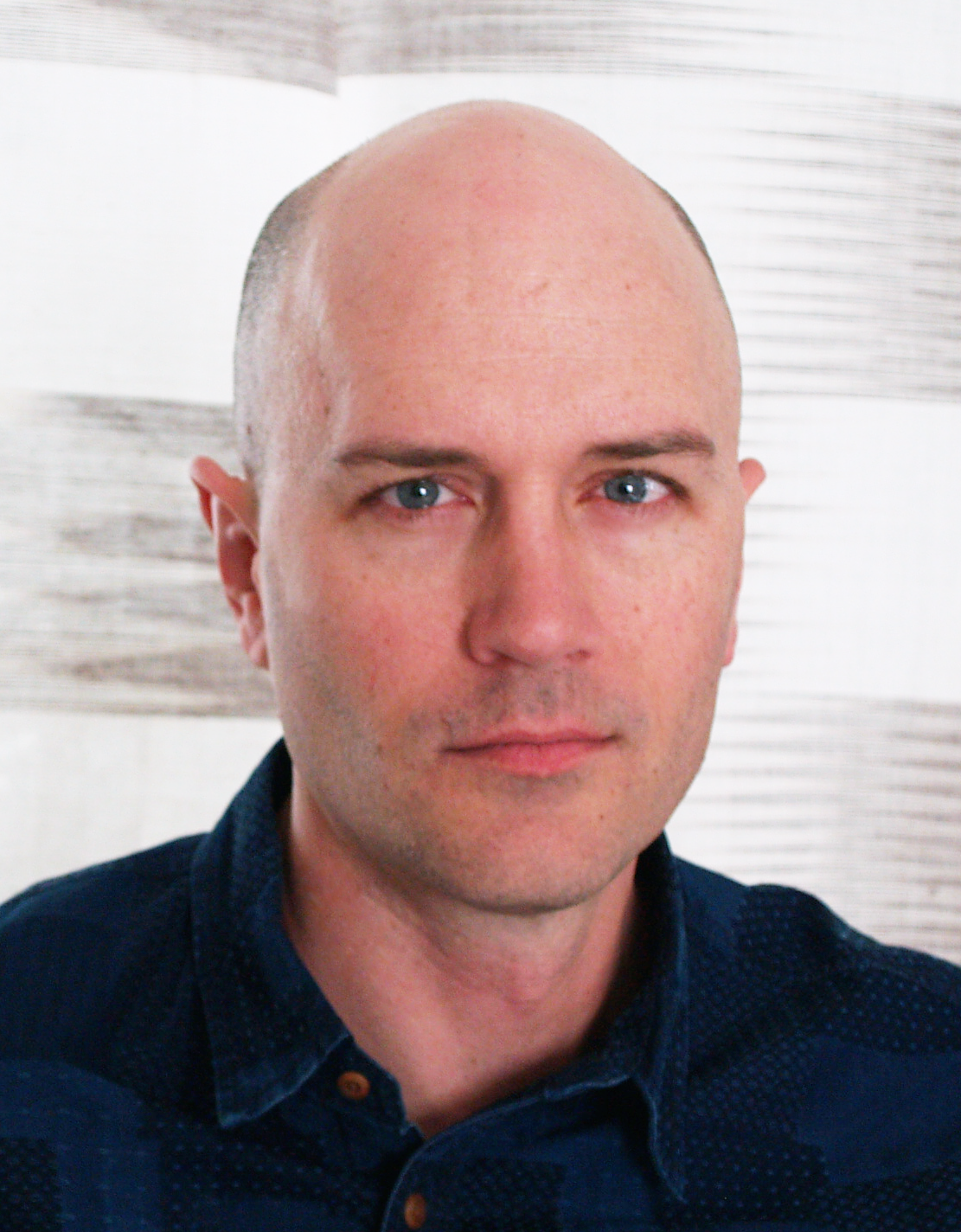
ML Reproducibility: Sources of Algorithmic, Implementation, and Observational Variability
Kevin Coakley | October 29, 2024 | Talk Tuesday Series
Kevin Coakley is a Computational and Data Science Research Specialist at the San Diego Supercomputer Center and UC San Diego focusing on AI reproducibility. Kevin holds a MAS in Architecture-based Enterprise Systems Engineering and Leadership from UC San Diego and is pursuing a PhD in Computer Science at the Norwegian University of Science and Technology. Kevin specializes in training and evaluating machine learning models for accuracy and reproducibility in applications like image recognition, time series prediction, and natural language processing.
Open Science Practices in Support of Arctic Research Applications
Dr. Anthony Arendt | October 8, 2024 | Talk Tuesday Series
Drawdown and Effective Science Communication Strategies
Dr. Rachel Brennan | September 17, 2024 | Talk Tuesday Series
Rachel Brennan, Ph.D., P.E. is a Professor and Interim Associate Head of Civil and Environmental Engineering at The Pennsylvania State University and holds a courtesy appointment in Agricultural and Biological Engineering. Dr. Brennan’s research expertise is the development and application of enhanced bioremediation technologies for restoring environments contaminated with acid mine drainage, petroleum hydrocarbons, hazardous wastes, nutrients, and trace organic chemicals. She currently leads several large research and education initiatives for solving sustainability challenges at the water-energy-food (WEF) nexus in developed and developing communities with an emphasis on reducing greenhouse gas emissions, protecting biodiversity, and championing human rights. Leveraging the power of engineered and natural ecosystems, Dr. Brennan’s research team develops strategies to purify water from complex waste streams and produce a range of value-added products to support a circular bioeconomy, including fertilizers, fuels, and food.
IceCube Science and Computing
Dr. Benedikt Riedel | August 20, 2024 | Talk Tuesday Series
Benedikt Riedel is the Computing Manager for the IceCube Neutrino Observatory and the Heterogeneous Systems Lead for the Accelerated AI Algorithms for Data-Driven Discovery. His research focuses on machine learning methods for neutrino astrophysics, high throughput data processing, distributed systems, and workflow management. He earned his Ph.D. in Physics in 2014 from UW-Madison.
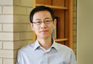
Differentiable modeling for continental- and global-scale water sciences
Dr. Chaopeng Shen | April 16, 2024 | Talk Tuesday Series
Abstract
Process-based modeling offers interpretability and physical consistency in many domains of geosciences but struggles to leverage large datasets efficiently. Machine-learning methods, especially deep networks, have strong predictive skills yet are unable to answer specific scientific questions or elucidate physical processes. A recently proposed genre of physics-informed machine learning, called “differentiable” models (https://t.co/qyuAzYPA6Y), connect neural networks (NNs) with process-based equations (priors) to benefit from the best of both NNs and process-based modeling paradigms. We propose that differentiable models are especially suitable for flood forecasting as well as continental- or global-scale water sciences. They can harvest information from big earth observations to produce state-of-the-art predictions that supercede purely data-driven models, enable physical interpretation naturally, extrapolate well (due to physical constraints) in space and time, and leverage progress in modern AI computing architecture and infrastructure. Differentiable models can also synergize with existing hydrologic models, learn from the lessons of the community and distinguish better priors. We demonstrate the power of differentiable modeling using computational examples in rainfall-runoff modeling, flood forecasting, river routing, as well applications in water-related domains such as ecosystem modeling and water quality modeling. Furthermore, we show how differentiable modeling can enable us to ask fundamental questions in water sciences, ecohydrology, and water quality.
Chaopeng Shen is an Associate Professor in Civil Engineering at The Pennsylvania State University. He received the Ph.D. degree in environmental engineering from Michigan State University, East Lansing, MI, USA, in 2009. His PhD research focused on computational hydrology and he developed the hydrologic model Process-based Adaptive Watershed Simulator (PAWS), which was later coupled to the community land model to study the interactions between hydrology and ecosystem. He was a Post-Doctoral Research Associate with the Lawrence Berkeley National Laboratory, Berkeley, CA, USA, from 2011 to 2012, working on high-performance computational geophysics. His recent efforts focused on harnessing the big data and machine learning (ML) opportunities in advancing hydrologic predictions and understanding. As an early advocate for machine learning in geosciences, he currently promotes differentiable modeling to integrate ML and physics for knowledge discovery and improved modeling of climate change impacts. He has written technical, editorial, review and collective opinion papers on hydrologic deep learning to call to attention the emerging opportunities for scientific advances. In addition, his research interests also include floodplain systems, scaling issues, process-based hydrologic modeling, and hydrologic data mining. He is currently an Editor of Journal of Geophysical Research – Machine Learning and Computation, and Associate Editor of the Water Resources Research and Chief Special Editor for Frontiers in AI: Water and AI.
Notes from the field: an overview of the motivation-for and approach-to ice penetrating radar data collection at Thwaites Glacier, West Antarctica
Dr. Nick Holschuh | March 26, 2024 | Talk Tuesday Series
Abstract
Changes to the ocean, in part driven by our emissions of CO2, have caused the acceleration of ice flow in West Antarctica. This enhanced discharge has resulted in a net mass loss from the Antarctic ice sheet, which contributes ~0.5 mm/a to global sea level rise. Thwaites Glacier, which sits in a deep marine basin in West Antarctica, is thought to be unstable in the face of ocean warming, but the rate and magnitude of ice loss there depends on unknown material properties of the glacier substrate. In his talk, Dr. Holschuh will discuss a geophysical campaign conducted on Thwaites Glacier during the 2023/24 Austral Summer, designed to constrain models of ice flow over the coming century. This will include an overview of ice penetrating radar, a discussion of the challenges in automated interpretation of ice penetrating radar data, and a description of the logistics-for and experience-of collecting data on one of Earth’s most rapidly changing glaciers.
Nick Holschuh is an Assistant Professor of Geology at Amherst College. His primary research interest is in improving our understanding of ice, rock, and water interactions at the base of glaciers using observational geophysics. That work has taken him to Antarctica four times, most recently to Thwaites Glacier, where he has used ice penetrating radar, active and passive seismic techniques, and gravimetry to measure the glacier subsurface.
Arctic OSSEs and Beyond
Dr. Nikki Privé | February 13, 2024 | Talk Tuesday Series
Abstract
Observing System Simulation Experiments (OSSEs) are a type of digital twin framework used to simulate the potential impact of future observing networks on numerical weather prediction. This talk will give an overview of how data assimilation and OSSEs work, along with best practices for designing and conducting OSSEs. Available products and resources for building an OSSE framework will be described. Some challenges particular to developing OSSEs for polar regions will also be discussed.
Nikki Privé is an Associate Research Scientist at Morgan State University with GESTAR-II as a cooperative agreement employee with NASA Goddard Space Flight Center. She completed a B.S. in mechanical engineering at University of Maryland, College Park, followed by an M.S. and Sc.D. in meteorology at MIT. Nikki has worked on Observing System Simulation Experiments (OSSEs) for numerical weather prediction (NWP) both with the NOAA Earth Science Research Laboratory and at the Global Modeling and Assimilation Office (GMAO). Much of her research has focused on the roles of model and initial condition error in forecast skill, the calculation of observation impacts on numerical weather prediction, and the design of realistic OSSE frameworks.
Exploring low level image processing to boost middle and high-level computer vision tasks
Dr. Xavier Soria Poma | November 14, 2023 | Talk Tuesday Series
Abstract
Since the advent of automatic image processing in the 60s of the 20th centuries, enormous advances have been made. Several fields have made use of computer vision and image processing tasks as a result of these breakthrough topics, from smile detection in smartphone’s cameras to space exploration in the vast universe. The first part of this presentation will introduce low-level image processing from the very beginning. I will briefly summarize the image edge detection task, highlighting current investigation and advances in this field. Secondly, I will present the contribution of my team in the edge detection domain; particularly, I will focus on how we see the problem and what advantages our proposal has over existing state-of-the-art models. Finally, I will show how edge detection boosts and improves work in different fields, such as breast cancer detection, calculation of ice sheet thickness from radar images and so on. All the models and datasets presented in the talk are freely available.

Dr. Xavier Soria is a research scientist working in image processing and computer vision. His current research focuses on advancing the fields of the image Edge Detection and thermal image Super Resolution driven by Artificial Intelligence (AI) models. He is interested in developing lightweight and efficient models. His contributions have transcended the initial domains and are now being applied to various high-level computer vision applications. Currently, he is an Adjunct Professor at the National University of Chimborazo and an Associate Researcher at the ESPOL Polytechnique University, both in Ecuador.
Keeping Our Heads Above Water: Periodic Updating of Science-Based Sea-Level Rise Projections for Planning in Maryland
Dr. Donald Friedrich Boesch | October 31, 2023 | Talk Tuesday Series
Abstract
As part of its efforts to address the climate crisis, the State of Maryland, with its 3,190 miles of shoreline and extensive low-lying coastal land, has, beginning in 2008, used sea-level rise projections in its planning. In 2015 the University of Maryland Center for Environmental Science was legally directed to update these projections at least every five years, with the latest projections produced in June 2023. Because it is important that projections have a solid scientific basis, we have used IPCC Assessments as the foundation, with the most recent projections relying on the Sixth Assessment Report (AR6). For the first time, the IPCC included Low Confidence projections that include unexpectedly rapid polar ice sheet loss, in addition to its Medium Confidence projections. Location specific, probabilistic projections based on the IPCC emissions pathway scenarios are provided through 2150 by NASA’s Sea Level Projection Tool. These projections include the effects of sterodynamic sea level and losses from water storage on land, glaciers, Greenland and Antarctica, in addition to local vertical land motion. We focused on a moderately mitigated emissions pathway (SSP2.4.5) based only on current commitments as the most plausible representation of the coming century, but also include estimates based on doubling of emissions by the end of this century (SSP3-7.0) and achieving the <2°C Paris Agreement goal (SSP1-2.6). These projections, along with extrapolations of tide gauge and satellite observations, indicate that relative sea-level rise will likely be between 0.3 m and 0.5 m by the middle of the century (from a 2005 base), beyond which the pathway of greenhouse gas emissions will have an increasingly significant influence, with polar ice sheet contributions growing if emissions are not reduced sufficient to meet the 2°C warming target. Under the current commitments only pathway, the best estimate of sea-level rise in Maryland in 2100 is 0.8 m, with the likely range of 0.6 to 1.1 m. Even with exceptionally rapid ice loss, it is very unlikely that it would exceed 1.5 m. Probability levels associated with these projections will be used as reference points for planning for both the natural and built environment.
Donald Friedrich Boesch, Ph.D. is President Emeritus and Professor Emeritus of the University of Maryland Center for Environmental Science (UMCES). From 1990 to 2017 he served as UMCES President; for the last nine of those years, he was also Vice Chancellor for Environmental Sustainability of the University System of Maryland.
Don Boesch received a B.S. in biology from Tulane University and a Ph.D. in oceanography from the College of William and Mary. Before coming to Maryland, he was a faculty member at William and Mary and the Louisiana State University. Don served on the Chesapeake Bay Cabinet under Governors Schafer, Glendening, Ehrlich, O’Malley and Hogan, and as a member of the Maryland Commission on Climate Change. He advised members of the General Assembly in crafting key legislation addressing the climate crisis, including the Greenhouse Gas Emissions Reduction Acts of 2009 and 2012 and the 2022 Climate Solutions Now Act. He continues to contribute to Maryland’s response to climate change, leading the recent update of Sea-Level Rise Projections for Maryland 2023.
Don has served on numerous committees and boards for U.S. federal agencies and for the National Academies of Sciences, Engineering and Medicine. He was a contributing author to the first and second U.S. National Climate Assessments. He served chair of the Academies’ Ocean Studies Board and was a contributing author to the America’s Climate Choices report. In 2010 he was appointed by President Obama as one of seven members of the National Commission on the BP Deepwater Oil Spill and the Future of Offshore Drilling.
Harnessing AI Challenges for Earth Science Problems: From Space to Physics
Dr. Yiqun Xie | October 10, 2023 | Talk Tuesday Series
Abstract
Advances in deep learning have continued to set new expectations for general tasks (e.g., computer vision, natural language processing) and bring new potential to harness geospatial big data for Earth Science problems. However, direct applications of deep learning often fall short due to challenges posed by geospatial data, including spatial heterogeneity/variability, sparse labels, etc. This talk will start with two general frameworks that explicitly tackle the challenges with: (1) A heterogeneity-aware framework that automatically recognize and handle spatial variability during model training; and (2) A physics-informed meta-learning framework that learns to select ensembles of physical models to assist training and reduce the need of labeled data. Then, the talk will show several examples of use-inspired AI for Earth Science, with applications in ICESat-2 height interpolation, global ecosystem model approximation, and label-free cloud masking. Finally, I will discuss our recent work on a coincidental data discovery platform to facilitate Arctic research.
Dr. Yiqun Xie is an Assistant Professor in Geospatial Information Science at the University of Maryland. He received his PhD in Computer Science at the University of Minnesota. One-size AI does not fit all. His research addresses challenges facing AI for spatial data, including heterogeneity, sparse training data, and locational bias. The spatial-aware AI techniques developed by his group have received multiple best paper awards from flagship conferences, including IEEE International Conference on Data Mining, SIAM International Conference on Data Mining, ACM SIGSPATIAL, and SSTD. His work was also highlighted by the Great Innovative Ideas at the Computing Community Consortium, Computing Research Association. His work is currently supported by the NSF, NASA, Google, etc.
Ghub: A science gateway for unifying ice sheet science and education
Dr. Sophie Goliber | September 26, 2023 | Talk Tuesday Series
Abstract
The urgency in reducing uncertainties of near-term sea level rise relies on improved modeling of ice sheet response to climate change. Predicting future ice sheet change requires a tremendous effort across a range of disciplines in ice sheet science, including expertise in observational data, paleoglaciology, numerical ice sheet modeling, and the widespread use of emerging methodologies for learning from the data. However, significant knowledge and disciplinary barriers make collaboration between data and model groups the exception rather than the norm. We seek to improve the efficiency in collaboration among traditionally disparate approaches to this problem. We present Ghub, a community-building scientific and educational cyberinfrastructure that includes models and data processing tools, online simulation, and collaboration support, available for use at theghub.org. Ghub enables collaboration between ice sheet scientific communities and acts as a host for the open-source tools that are becoming more common in the field of ice sheet science. We provide an overview of the Ghub framework, with examples of tools, tutorials, and educational content that are ready to use, and visions for extending these and other upcoming developments. These tools target a wide range of audiences, ranging from ice sheet modeling community efforts such as the Ice Sheet Model Intercomparison Project for CMIP6 (ISMIP6) to more specialized process-orientated investigations. We also outline the process for scientists to host their data and tools on the platform.
Sophie Goliber earned her Ph.D. in geological sciences from the University of Texas at Austin where she focused on understanding the controls on changes at marine-terminating glaciers in Greenland using the recent satellite record. Her undergraduate degree was earned at the University at Buffalo in Geology, where she is now returning as a postdoc working on the Ghub science gateway to enable ice sheet scientists to work more collaboratively and efficiently. Her work focuses on scientific community management, outreach, and education related to ice sheet science as well as continued research into the ice-ocean interface at Greenland’s glaciers.
The Dynamics of Megafire Smoke Plumes in Climate Models: Why a Converged Solution Matters for Physical Interpretations
Dr. Stephen Guimond | August 15, 2023 | Talk Tuesday Series
Abstract
As the climate system warms, megafires have become more frequent with devastating effects. A byproduct of these events is the creation of smoke plumes that can rise into the stratosphere and spread across the globe where they reside for many months. To gain a deeper understanding of the plume dynamics, global climate simulations of a megafire were performed at a wide range of grid spacings from 2.0° down to 7 km, including a 7 km nonhydrostatic experiment. The analysis focuses on how the resolved dynamics affects the specification of the plume characteristics such as injection height and black carbon (BC) mass. Prior studies initialize the smoke plume at one or a few grid points and this is shown here to produce severely dissipative dynamics. In order to validate such simulations with observations, enhancements of the plume characteristics to offset the dissipation is necessary. Using a numerically converged simulation, sensitivity tests show that to approximate the observed stratospheric lifetime, a reduction in BC fraction by 50% is necessary for external mixtures. The vorticity dynamics of the plume is also analyzed with a Lagrangian budget to understand the mechanisms responsible for the evolution of a collocated anticyclonic vortex. The results can be distilled down into a simple conceptual model. As the plume rises, the air diverges at the top of the updraft where the largest concentrations of smoke are found. This divergence induces a dilution of the background cyclonic absolute vorticity producing an anticyclonic vortex. Vortex decay occurs from opposite arguments.
To read the related research article please click here.
Steve Guimond is an Associate Research Professor in the Department of Physics at the University of Maryland Baltimore County (UMBC) and scientist in the Mesoscale Atmospheric Processes Laboratory at NASA Goddard Space Flight Center (GSFC). His research portfolio consists of: (1)Remote sensing with a focus on airborne radar including designing algorithms for computing geophysical variables such as winds, latent heat & precipitation and (2)Geophysical fluid dynamics with a focus on hurricanes, convection, turbulence & computational methods. His most recent work focuses on wildfire smoke plume modeling with the NASA GEOS system funded by the Department of Energy/Los Alamos National Laboratory.
Share or Perish: Open Science, Open Data and What it All Means to iHARP Researchers
Dr. Maria Esteva | June 20, 2023 | Talk Tuesday Series
Abstract
This talk will introduce open data theory and practices including recent requirements for federally funded projects generating models and data. We will discuss the reasons why curating data is fundamental for research reproducibility and reliability, as well as how it contributes to multiply the impact of research. What curation entails in terms of researchers’ efforts and research infrastructure requirements will also be presented. In particular, we will brainstorm about how all of this is pertinent to iHARP.
Active learning on the ice sheet: Classroom mapping of meltwater lakes and cracks in satellite imagery
Edward Boyda and Kim Young | May 23, 2023 | Talk Tuesday Series
Abstract:
Earthrise Education creates project-based learning curricula for middle- and high-school classrooms, with elements of remote sensing data science and environmental and environmental justice themes. Projects invite students to engage in real-world investigative and mapping activities using satellite imagery, generating data for journalist, NGO, or scientific partners.
The current project, run in partnership with iHARP, takes on climate change and the cryosphere. Students delineate meltwater lakes, cracks, and moulins in Planet Labs SkySat imagery over the Greenland ice sheet, for use as training data for future machine-learned systems. We first present some background and results from the initiative. As of writing, 650 students from 9 schools have participated, creating 23,909 labeled features. A teacher and students will relate their experience with the project, describing high student engagement in contributing to the iHARP scientific program.
Edward Boyda is a physicist and a co-founder of Earthrise Media, where he runs satellite-based investigations for environmental and human rights reporting. He helped build the neural network pipelines behind Amazon Mining Watch and Global Plastics Watch and contributed data reporting to dozens of stories in the international news media. He is a research member of the AI-Journalism Resource Center at OsloMet University.
Previously, Edward was an Associate Professor of Physics at Saint Mary’s College of California and a researcher in quantum computing at the BAER Institute at NASA Ames Research Center.
Key Drivers of Marine Ecosystem Change under Climate Warming: Results from the Distributed Biological Observatory in the Pacific Arctic
Professors Lee W. Cooper, and Jacqueline M. Grebmeier | April 19, 2023 | Distinguished Guest Speaker
Abstract:
In the Pacific Arctic, warming seawater and reduced sea ice have changed the state of the marine ecosystem in the northern Bering and Chukchi Seas. Changes in upper-ocean hydrography, primary productivity, pelagic-benthic coupling and carbon cycling, and lower and upper trophic levels are being evaluated through the Distributed Biological Observatory (DBO). This cooperative venture was initiated in 2010 and includes international coordination of research cruises. The DBO emphasizes standardized sampling on set transect lines to measure ecosystem status and environmental trends. Continuous data are also obtained through moorings, satellite observations, and autonomous sampling. DBO sampling has revealed that seasonal and interannual hydrographic changes are driving shifts in species composition, distribution and abundance, with northward range expansions into Arctic waters for some temperate species and negative impacts for some cryophillic species. The seasonal timing of phytoplankton growth influences organic materials exported to epi- and infaunal benthic animals, which are important prey for benthic-feeding marine mammals and seabirds. Sediments are also indicators of changing organic carbon deposition providing seasonal and interannual records of water column biological events. This presentation will highlight findings from studies of biological change, the use of sediment chemistry to understand ecosystem status, and key physical drivers for these observed changes.
Jackie Grebmeier is a Professor at the Chesapeake Biological Laboratory of the University of Maryland Center for Environmental Science. Her oceanographic research interests are related to pelagic-benthic coupling, benthic carbon cycling, and benthic faunal population structure in the marine environment. Her field research program in the Arctic has focused on such topics as understanding how water column processes influence biological productivity in Arctic waters and sediments, how materials are exchanged between the sea bed and overlying waters, and documenting longer-term trends in ecosystem health of Arctic continental shelves. Research projects have included analyses of the importance of benthic organisms to higher levels of the Arctic food web, including walrus, gray whale, and diving sea ducks, and studies of radionuclide distributions in sediments and within the water column in the Arctic as a whole. She is a Fellow of the American Association for the Advancement of Science, a recipient of the International Arctic Science Committee Medal, and she has also served on a number of advisory and review committees to the U.S. National Academy of Sciences, Polar Research Board, National Science Foundation (NSF), National Oceanographic and Atmospheric Administration (NOAA), and Fish and Wildlife Service, and she was appointed to the US Arctic Research Commission by President Clinton. She also served as project director and chief scientist for a National Science Foundation and Office of Naval Research-supported field research program in the Beaufort and Chukchi Seas that investigated the exchange of materials between the continental shelves and the deeper Arctic basin in the context of global change (Shelf-Basin Interactions Phase II, 2001-2007), as well as a number of other interdisciplinary projects in the Arctic. A current effort is the internationally coordinated Distributed Biological Observatory in the Arctic that is supported by a number of US agencies, as well as science agencies in Canada, Korea, Japan and China.
PolarMERRA: A Polar-Focused Global Reanalysis Project for Scientific and Stakeholder Needs
Dr. Lauren Andrews | April 19, 2023 | Talk Tuesday Series
Abstract
The adequate modeling of physical processes in the Arctic and Antarctic is vital for developing prediction capabilities and for obtaining an understanding of rapidly evolving polar conditions, including their potential global impacts. These processes are often poorly represented in global models and reanalyses, owing to a legacy modeling focus on midlatitude processes, as well as a scarcity of observations needed for model development in polar regions. The polarMERRA initiative, a joint effort between NASA’s Cryospheric Sciences and Modeling and Prediction programs, seeks to improve the representation of cryospheric and polar atmospheric processes and to develop an open-source framework for a quantitatively evaluation of polar-relevant variables against current and future satellite and in-situ observations, models, and reanalyses.
Here, we evaluate the impacts of spatial resolution and modifications to sea ice, ice sheet, and atmospheric parameterizations on the representation of high latitude conditions by using a quantitative scorecard approach that leverages NASA’s extensive satellite record. Investigations are conducted using the NASA Goddard Earth Observing System model (GEOS) and its data assimilation system (GEOS DAS). Through a quantitative identification of process deficiencies, bias reductions in key surface variables, including temperature and precipitation over cryospheric surfaces, may be achieved. The polarMERRA project additionally seeks to identify additional data sources for use in the GEOS DAS, and to incorporate data and parameterization improvements into future model and reanalysis products for scientific and stakeholder use.
Dr. Lauren Andrews is an earth scientist with the Global Modeling and Assimilation Office (GMAO) at NASA Goddard Space Flight Center (GSFC). Her research focuses on understanding the role of the cryosphere in the Earth system, including how glacial meltwater can alter the dynamic response of ice sheets and glaciers and how the representation of cryospheric processes, including snow and sea ice, can impact sub-seasonal to seasonal forecasting. She is a member of the GMAO Subseasonal-to-Seasonal Prediction Team, and she leads the PolarMERRA Reanalysis Project, a joint effort between GMAO and GSFC Cryospheric Sciences Lab, to produce a high-resolution atmospheric reanalysis focused on the representation of polar regions.
POLARIS: The Pursuing Opportunities for Long-term Arctic Resilience for Infrastructure and Society
Dr. Guangqing Chi | March 14, 2023 | Talk Tuesday Series
Alaskan coastal Indigenous communities face severe, urgent, and complex social and infrastructural challenges resulting from environmental changes. However, the magnitude and significance of impacts are unclear; as is how local communities will respond to resulting disruptions and disasters. This POLARIS project investigates how interconnected environmental stressors and infrastructure disruptions are affecting coastal Alaskan communities and identifies important social, environmental, infrastructural, and institutional assets to help them adapt and become more resilient to climate-related changes. The POLARIS project has identified three convergent and interconnected research pillars to help communities adapt: environmental hotspots of disruption to communities and infrastructure, food in complex adaptive systems, and migration and community relocation.
The ultimate goal of this integrated research project is to enable communities to become more resilient with both stronger societies, civic culture, and improved infrastructure needed as the new Arctic continues to emerge. In addition to introducing the POLARIS project, this talk will highlight one of its studies—the COVID-19 pandemic impacts on fishing communities in Alaska.
Bristol Bay in Alaska is home to the world’s largest commercial salmon fishery. During an average fishing season, the population of the Bristol Bay region more than doubles as thousands of workers from out of state converge on the fishery. In the months leading up to 2020 commercial fishery opening, as the COVID-19 pandemic exploded worldwide, great uncertainty existed about the health risks of opening the fishery. Bristol Bay residents had not yet experienced any cases of COVID-19, yet the livelihoods of most were closely tied to the commercial fishery opening. To better understand how COVID-19 risk perceptions affected decisions to participate in the fishery, we administered an online survey to community members and fishery participants. We collected standard socioeconomic data and posed questions to gauge risk perceptions related to COVID-19. We find that COVID-19 risk perceptions vary across race/ethnic groups by residency and income. People with below median income who are members of minority groups—notably, non-resident Hispanic workers and resident Alaska Native respondents—reported the highest risk perceptions related to COVID-19. It is also the same demographic group who had the highest participation in the fishing season. This study highlights the important linkages among risk perceptions, socioeconomic characteristics, and employment decisions during an infectious disease outbreak.
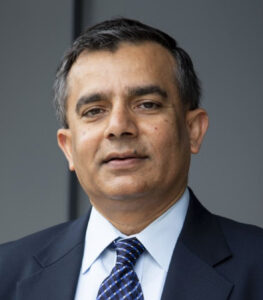
Exploring physical and Machine Learning approaches for stochastic modeling and ensemble prediction of weather and climate
Dr. Aneesh Subramanian | February 21, 2023 | Talk Tuesday Series
Abstract:
Convection and cloud processes play a key role in the dynamics of the atmosphere just as mesoscale turbulence and deep convection do in ocean dynamics and ice-shelf processes do in ice sheet dynamics. Yet, even today our shortcomings in parameterizing these subgrid scale processes in global climate models (GCMs) are limiting our ability to simulate and understand the climate and weather of the planet. Recent innovative ideas on convection parameterization such as super-parameterization (embedding cloud-resolving models within the GCM grid), stochastic-parameterization or machine learning emulation in weather and climate models have helped improve its representation of the climate and weather systems. These approaches in parameterization have emerged as new paths forward and complement the conventional approaches rather than replace them. We study the impact of these approaches on forecasts from weather to climate timescales. Results from studies using stochastic parameterization in ensemble forecasting systems as well as machine learning approaches for causal discovery, feature detection and ensemble prediction post-processing will be presented. In addition, results from using machine learning approaches for stochastic parameterization of subgrid-scale variability in an idealized system will be presented to motivate future studies in this direction with the weather and climate forecasting systems. This has implications on improving conventional parameterization using hybrid approaches as we await the exascale computing systems of the future to resolve key processes in climate models.
Dr. Aneesh Subramanian, Assistant Professor of Atmospheric and Oceanic Sciences at CU Boulder, as well as iHARP Co-PI. He is also a visiting scientist at the Center for Western Weather and Water Extremes at Scripps Institution of Oceanography, UC San Diego, and a visiting scholar in the Predictability of Weather and Climate group in the Physics Dept. at the University of Oxford. Dr. Subramanian brings expertise in climate dynamics and recent experience using machine learning techniques for varied climate science applications.
A journey in science research, education, and cooperative center administration
Dr. Belay Demoz | November 17, 2022 | Talk Tuesday Series
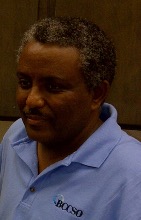
Belay holds a doctoral degree in Atmospheric Physics from the University of Nevada and Desert Research Institute in Reno, Nevada. Prior to joining UMBC/JCET, he was Professor of Physics at the Department of Physics and Astronomy at Howard University, where he was Director of Graduate Studies for the Physics Department and also one of the Principal PI’s at the Beltsville Research Campus. Before joining academia, Dr. Demoz has worked for the private industry as a NASA contractor, followed by some time as a Civil Servant at NASA/GSFC in the Mesoscale Dynamics Branch. His research interests include mesoscale observation and instrumentation in atmospheric physics and climate as well as atmospheric science influence in climate policy. He has chaired the Committee for Atmospheric LIDAR Application Studies (CLAS) for the American Meteorological Society; is a member of the Atmospheric Observation Panel for Climate (AOPC) Working Group on GRUAN (WG-GRUAN); and has served as Associate Editor for the Journal of Geophysical Research, the web magazine Earthzine (http://www.earthzine.org/) and many other editorial boards. He has organized national and international conferences and workshops and serves in a number of working groups and international organization and also serves as an adjunct Professor at University of Utah. He is also active in organizing national and international research field observations (e.g. WAVES 2007, IHOP2002, PECAN 2015 for example). He is the current Director of the Joint Center for Earth Systems Technology (JCET: http://jcet.umbc.edu).
Zachariæ Isstrøm, North East Greenland, Ice Shelf Changes From Landsat – 1975 to 2021 and Landsat@50
Dr. Christopher Shuman | October 18, 2022 | Talk Tuesday Series
What is special about Geo-AI and Spatial data science?
Dr. Shashi Shakhar | September 13, 2022 | Talk Tuesday Series
Abstract: Rise of spatial big data (e.g., trajectories, remote-sensing) is fueling growth of Geo-AI (e.g., geo-imagery analysis automation) for making previously unimaginable maps, answering trail-blazing geo-content based queries, and understanding spatiotemporal patterns of our lives, etc. Applications span from apps for navigation, ride-sharing, and delivery to monitoring global crops, climate change, diseases, and smart cities to understanding cellular or urban patterns of life.
However, one-size-fit-all machine learning performs poorly (e.g., salt-n-pepper noise, inaccuracy) due to spatial autocorrelation and variability, which violate the common i.i.d. assumption (i.e. data samples are generated independently and from identical distribution). Furthermore, high cost of spurious patterns requires guardrails such as noise tolerance, and modeling of spatial concepts (e.g., polygons) and implicit relationships (e.g., distance, inside). In addition, methods discretizing continuous space face the modifiable areal unit problem (e.g., gerrymandering).
Thus, the talk suggests spatial data science approaches and describes methods for spatial classification and prediction (e.g., spatial auto-regression, spatial decision trees, spatial variability aware neural networks) along with techniques for discovering patterns such as noise-robust hotspots (e.g., SaTScan, linear, arbitrary shapes), interactions (e.g., co-locations, tele-connections ), spatial outliers, and their spatio-temporal counterparts (e.g., cascade , mixed-drove co-occurrence ). It concludes by calling for inclusion of spatial perspectives in data science courses and curricula.
Bio: Shashi Shekhar is a leading scholar of spatial data science, spatial computing and Geographic Information Science (GIS). Currently, he is a Mcknight Distinguished University Professor and a University Distinguished Teaching Professor at the University of Minnesota (UMN). Recognitions include IEEE-CS Technical Achievement Award, UCGIS Education Award, IEEE Fellow, AAAS Fellow. He was also named a key difference-maker for the field of GIS by the most popular GIS textbook.
He is serving on the Computing Research Association (CRA) board (2016-22), a co-chair for the CRA Snowbird conference (2022), a co-Editor-in-Chief of Geo-Informatica (Springer), and a program co-chair for ACM SIGSpatial Intl. Conference (2022). Earlier, he served as the President of the University Consortium for GIS (UCGIS), and on many National Academies’ committees including Geo-targeted Disaster Alerts and Warning (2013), Future Workforce for GEOINT (2011), Mapping Sciences (2004-2009) and Priorities for GEOINT Research (2004-2005).
In 1990s, Shashi’s research developed roadmap storage and routing methods, which have revolutionized outdoor navigation. His evacuation route planning algorithms were used for homeland security and received many recognitions including the UMN CTS Award for significant impact on transportation. His recent research is analyzing spatial big data to recommend eco-routes to reduce emissions and energy use. He also pioneered spatial data mining research area via pattern families (e.g. colocation), keynotes, surveys and workshops.
Shashi’s 350+ publications include a popular textbook on Spatial Databases (Prentice Hall, 2003), an authoritative Encyclopedia of GIS (Springer, 2017) and a spatial computing book for broad audience. Many of Shashi’s 100 advisees are serving in leadership positions and have received prestigious recognitions such as the Presidential Early Career Awards for Scientists and Engineers and NSF CAREER.
Shashi received a Ph.D. degree in Computer Science from the University of California (Berkeley, CA). More details are available from http://www.cs.umn.edu/~shekhar.
Emerging Hydrologic Feedbacks on the Greenland Ice Sheet: Recent Discoveries and Unanswered Questions
Dr. Michael MacFerrin | May 24, 2022 | Talk Tuesday Series
Abstract: As Arctic climate warms, the Greenland ice sheet has undergone enormous hydrologic changes over the past few decades. Recent advances in satellite, airborne, and field-based observations are rewriting previous assumptions about how we believe the Greenland ice sheet behaves in a warming climate while also raising questions about its future potential for melt. Join glaciologist Mike MacFerrin as he reviews what glaciologists have recently been learning about how the Greenland ice sheet responds to a rapidly changing climate, the implications for interpreting its past, and the open questions being explored today about what the future holds for our northern ice sheet.
Want to stay informed about our upcoming webinars?
Sign up today and join us on our monthly Talk Tuesdays where we host guest speakers.
Talk Tuesdays will occur once a month and will take place 4p (EST) unless noted.
The button above will take you to a google form to complete the signup process.