Want to stay informed about our upcoming webinars?
Sign up today and join us on our monthly Talk Tuesdays where we host guest speakers.
Talk Tuesdays will occur once a month and will take place at 4p (EST) unless noted.
The above button will take you to a Google form to complete the subscription signup process.
Upcoming Virtual Events
All times listed are eastern standard time unless noted
A new series of excieting and engaging talks will be annouced soon.
Past Events
- Tuesday, May 13, 2025 at 4p: Dr. Aaron Deslatte (O’Neill School of Public and Environmental Affairs at Indiana University Bloomington & Metropolitan Governance and Management Transitions Laboratory) | Building Knowledge Infrastructure Systems Through University-Supported Climate Collectives
- Tuesday, May 20, 2025 at 4p: Dr. Mark Subbarao (lead, NASA’s Scientific Visualization Studio) | Designing visualizations for NASA’s Earth Information Center
- Tuesday, May 27, 2025 at 4p: Dr. Maria Molina (Department of Atmospheric and Oceanic Science at the University of Maryland, College Park) | Machine Learning Applied to Polar Regions and the Earth Systems
Tuesday, May 27, 2025 | 4p – 5p | Dr. Maria J. Molina
Machine Learning Applied to Polar Regions and the Earth Systems
Speaker: Dr. Maria J. Molina, Assistant Professor within the Department of Atmospheric and Oceanic Science at the University of Maryland, College Park
Talk Abstract
Polar regions are undergoing rapid and unprecedented change, with profound implications for the Earth systems. This seminar will explore how machine learning transforms our understanding of these remote and complex environments. From uncovering trends in Antarctic polynyas to disentangling links between polar processes and broader Earth system predictability, recent advances, methods, and opportunities for interdisciplinary collaboration will be discussed. This talk will also discuss how generative AI can accelerate research progress and facilitate classroom learning, and where AI can go wrong for scientific applications.
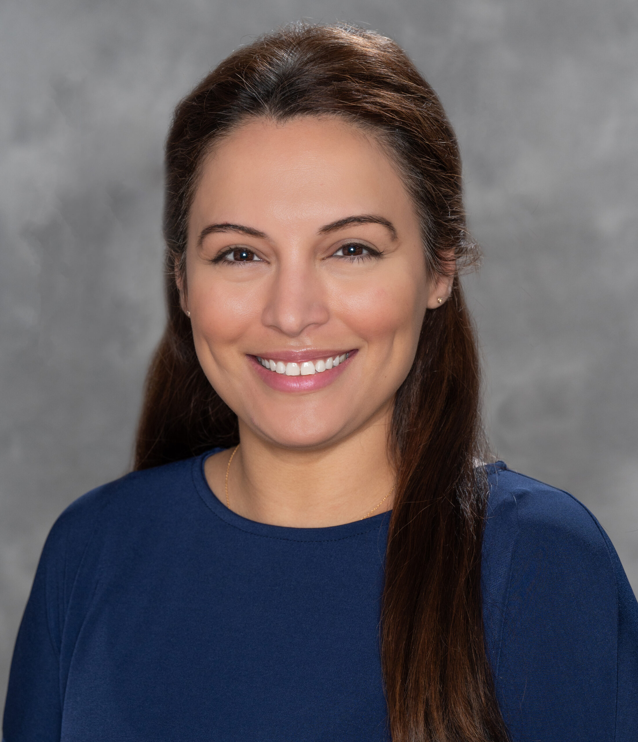
Dr. Maria J. Molina is an Assistant Professor within the Department of Atmospheric and Oceanic Science at the University of Maryland, College Park, and is affiliated with the Artificial Intelligence Interdisciplinary Institute at Maryland, the University of Maryland Institute for Advanced Computer Studies, and the National Science Foundation (NSF) National Center for Atmospheric Research. Her research broadly focuses on using machine learning for Earth systems understanding, prediction, and predictability. Maria serves as a member of the US Climate Variability and Predictability (CLIVAR) Predictability, Predictions, and Applications Interface panel and of the World Climate Research Program (WCRP) Scientific Steering Group for the Earth System Modeling and Observations (ESMO) core project. Recently, Maria earned the NASA Early Career Investigator Program in Earth Science award.
Tuesday, May 20, 2025 | 4p – 5p | Dr. Mark Subbarao
Designing visualizations for NASA’s Earth Information Center
Talk Abstract
Earth information from space supports decision makers, partners, and people in developing the tools needed to mitigate, adapt, and respond to our changing planet. At the Earth Information Center, visitors can see how our planet is changing in areas that affect lives and livelihoods– from temperatures in our cities to sea level rise, greenhouse gas emissions to agricultural productivity. The center showcases large, awe-inspiring visualizations, as well as interactive media, stories, and narratives, to show how viewing Earth from space can improve lives in the face of disasters, environmental challenges, and climate change. This talk will give an overview of the current and upcoming Earth Information Center installations and highlight some of the design considerations that go into creating effective climate data visualizations.
Tuesday, May 13, 2025 | 4p – 5p | Dr. Aaron Deslatte
Building Knowledge Infrastructure Systems Through University-Supported Climate Collectives
Speaker: Dr. Aaron Deslatte, Associate professor in the O’Neill School of Public and Environmental Affairs at Indiana University Bloomington and co-director of the Metropolitan Governance and Management Transitions Laboratory
Talk Abstract
Knowledge-based organizational capabilities are critical for continued human development and flourishing in the Anthropocene. Population growth, spatial development, and unsustainable resource use are all driving a need for new and diverse forms of knowledge to adapt social and physical infrastructures to climate change-driven environmental hazards. Despite a vast and expanding scholarship on environmental impacts and policy interventions, scholars have devoted less attention to how political systems or complex organizations curate and translate knowledge into implementation guidance or practice. This article addresses this challenge by empirically exploring a concept called “knowledge infrastructure systems,” developed by interdisciplinary sustainability scholars to broaden analytic attention to the methods by which organizations and resource users mobilize knowledge into practice. State and local governments are on the front lines of the implementation of many national climate policies. Yet, climate vulnerabilities and organizational capacities for planning and implementing innovative programs vary significantly between regions and between rural-suburban-urban divides. While an influx in federal funds for climate work in the United States has increased opportunities for local communities, the successful implementation of these intergovernmental programs is challenged by the limited capacity of the very communities these funds aim to support. Through an analysis of text and interview data, this article examines the capacity-building efforts and roles that university-based collaborative networks played in the rollout of one federal initiative, the Climate Pollution Reduction Grant Program, and the disparate distribution of benefits which resulted from this effort. We argue that greater attention to capacity-building and “knowledge infrastructure” is necessary to leverage funding opportunities for the equitable delivery of climate services.
Dr. Aaron Deslatte is an associate professor in the O’Neill School of Public and Environmental Affairs at Indiana University Bloomington. He co-directs the Metropolitan Governance and Management Transitions Laboratory, which focuses on the collective-action challenges surrounding community resilience and sustainability.
His research focuses on the roles that public managers play in enhancing economic, environmental and social sustainability at the local and metropolitan level, with the goal of building cumulative knowledge which can help local governments advance sustainable economic and community development.
Deslatte previously taught at Northern Illinois University and is a faculty affiliate with the IU Environmental Resilience Institute and the Vincent and Elinor Ostrom Workshop. He also spent many years as a journalist covering politics and government in Missouri, Kansas, Arkansas, and Florida, including a term as the Tallahassee Bureau Chief at the Orlando Sentinel.
He earned his Ph.D. in public administration from Florida State University. He also earned two master’s degrees from Florida State, including his MPA and M.S. in political science. His undergraduate degree is from Missouri Southern State University.
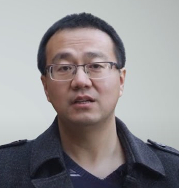
Tuesday, April 22, 2025 | 4p – 5p | Dr. Chandi Witharana
High-resolution Arctic Built Infrastructure and Terrain Analysis Tool (HABITAT)
Speaker: Dr. Chandi Witharana, Assistant Professor at University of Connecticut in the Department of Natural Resources & the Environment
Talk Abstract
There is an urgent need for advanced monitoring tools to accurately map Arctic permafrost landforms and thaw-related disturbances, track their evolution over time, and assess their economic impacts on human-built infrastructure. Over the past two decades, the entire Arctic has been repeatedly imaged by sub-meter resolution Maxar satellite sensors, resulting in data repositories containing millions of images and growing into the petabyte scale. Despite this wealth of data, geospatial products derived from imagery at a pan-Arctic scale remain rare. The challenge of scaling automated analysis across millions of square kilometers of heterogeneous Arctic landscapes underscores the demand for high-throughput data science pipelines. To address this gap, we developed the High-resolution Arctic Built Infrastructure and Terrain Analysis Tool (HABITAT) – a novel image analysis pipeline that brings operational-scale GeoAI capabilities into Arctic science applications. We demonstrate HABITAT’s utility through multiple Maxar-based mapping efforts, such as ice-wedge polygons (IWPs), ice-wedge polygon capillary networks, retrogressive thaw slumps, and human-built infrastructure features. HABITAT is designed to run efficiently on heterogeneous high-performance computing systems. One of HABITAT’s key outcomes is the creation of the first pan-Arctic ice-wedge polygon dataset, comprising over one billion individual IWPs across the tundra domain.
Dr. Chandi Witharana is an Assistant Professor in the Department of Natural Resources and the Environment at UConn’s College of Agriculture, Health and Natural Resources (CAHNR). He is the Director of UConn’s Remote Sensing and Geospatial Data Analytics Online Graduate Certificate. Dr. Witharana is also an affiliated faculty of Eversource Energy Center and the Institute for the Brain and Cognitive Sciences at UConn. He is a member of American Society for Photogrammetry and Remote Sensing and the American Geophysical Union. Dr. Witharana is the Director of ConnecticutView at UConn. He earned a PhD in Remote Sensing and an MS in GIScience at the University of Connecticut, and a BSc in Geology at the University of Peradeniya, Sri Lanka. Prior to joining the UConn faculty, he was a Post-doctoral Research Associate at the SUNY Stony Brook. Dr. Witharana was a Geospatial Analyst at the United Nations Office for the Coordination of Humanitarian Affairs. He conducts interdisciplinary remote sensing research speaking to the transformational uses of earth observation technology in environmental, industrial, and humanitarian applications.
Tuesday, April 8, 2025 | 4p – 5p | Dr. Eric Stokan
Transdisciplinary Collaborations to Address Our “Wicked Problems”
Speaker: Dr. Eric Stokan, Director of the Center for Social Science Scholarship (CS3), an associate professor of political science, and an affiliate faculty in the School of Public Policy at UMBC
Talk Abstract
This talk centers on building successful collaborations and partnerships to address the “wicked problems” we face within and across our communities. From developing strategic plans aimed at mitigating flooding to building alternative energy infrastructure, overcoming our disciplinary boundaries and leveraging knowledge across our colleges, institutions, and communities is an important pathway to addressing the most pressing challenges we face today.
The Director of the Center for Social Science Scholarship (CS3), Dr. Eric Stokan, will describe and highlight the results of partnerships between CS3 and COEIT and iHarp, the Metropolitan Governance and Management Transitions (MGMT) lab at IU Bloomington, and others. The talk will reflect on the results and outcomes of these collaborations.
The second part of the talk will highlight opportunities for increased engagement with social scientists and humanists and supports to make this happen. Drawing on social science and public management theory, this talk will make the case that finding these points of collaboration are increasingly important and necessary for the challenges ahead.
Dr. Eric Stokan is the Director of the Center for Social Science Scholarship (CS3), an associate professor of political science, and an affiliate faculty in the School of Public Policy at UMBC. He also serves as a faculty affiliate to the Center for Urban Studies at Wayne State University and is co-director and faculty affiliate to the Metropolitan Government and Management Lab (MGMT) at the Paul H. O’Neill School of Public and Environmental Affairs at Indiana University Bloomington. Dr. Stokan’s research explores how governments balance economic growth goals with community development activities and environmental protections equitably. Further, he studies the impact of local government policy decisions on economic and social equity outcomes.
Tuesday, February 18, 2025 | 4p – 5p | Dr. Jennifer (Jen) Delamere
Eyes Over Alaska: How JPSS Satellites See the 49th State
Speaker: Dr. Jennifer (Jen) Delamere, Director of Geographic Information Network of Alaska (GINA) at the University of Alaska Fairbanks, Associate Research Professor (Snow, Ice, and Permafrost Group at the Geophysical Institute)
Talk Abstract
Suomi-NPP, NOAA-20, and NOAA-21, and the innovative instruments they carry, are the most versatile observational assets we have for weather forecasting and hazard detection in the state of Alaska and its adjacent oceans. These satellites, part of the Joint Polar Satellite System (JPSS), are equipped with direct-broadcast technology, allowing continuous downlink of mission data to small antennas worldwide. Three direct-broadcast antennas, owned and operated by the Geographic Information Network of Alaska (GINA), are currently deployed in interior Alaska. This presentation will highlight how JPSS products are used today in Alaska to monitor wildland fires by the Alaska Fire Service, river flooding by the Alaska-Pacific River Forecast Center, precipitation by the National Weather Service offices, and sea ice movement by the Alaska Sea Ice Program. As important as the mission are the people that make them happen. GINA continually strives to develop, improve, and assess satellite products through partnerships with NOAA, NOAA Cooperative Institutes, government agencies, and universities. Examples of these partnerships will be presented.

Full-Cirlce Climate Communications Workshop
- Workshop Dates: January 13 – 17, 2025 (minimum 3-day commitment required for participants)
- Location: University of Maryland, Baltimore County (UMBC)
- Cost: There is no cost for the workshop. Travel and lodging expenses will be covered for non-iHARP scientists and non-UMBC participants traveling for the workshop.
Click here to navigate to the Full-Circle Climate Communications Workshop webpage for additional information, including how to express interest in attending.
Tuesday, December 3, 2024 | 4p – 5p | 3rd Annual Fireside Chat: Making Effective Presentations
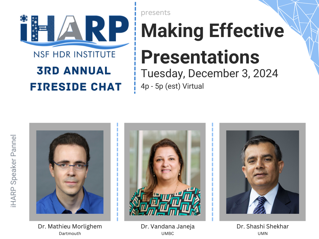
Come, relax, and join us for an engaging informal conversation with leading scientists and researchers. Learn how they create effective presentations to communicate their research and ideas. We will cover their struggles and successes and their tips and tricks that have made them successful.
Bring a warm drink and snacks, and cozy on up to the virtual fireside for our last 2024 Talk Tuesday event.
iHARP Senior Research Panel Includes:
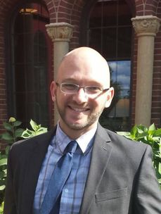
Dr. Vandana Janeja, UMBC — Associate Dean for Research and Faculty Development, Professor in Information Systems Department, PI & Director NSF HDR Institute – iHARP
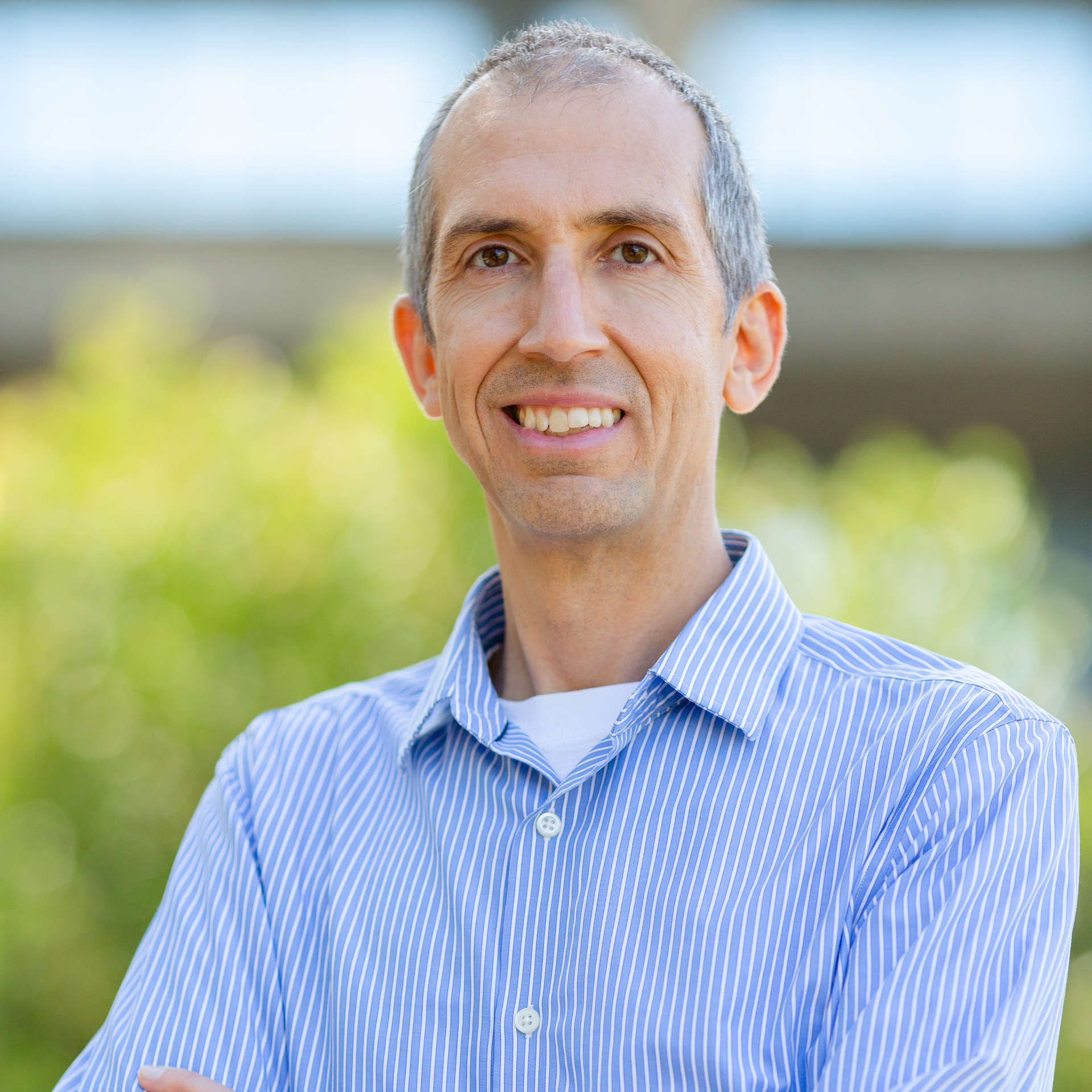
Dr. Mathieu Morlighem, Dartmouth — Professor in the Department of Earth Sciences at Dartmouth College, iHARP Co-PI & Co-Director
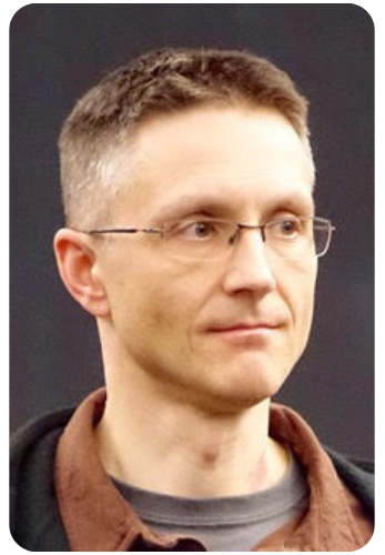
Dr. Shashi Shekhar, UMN — Professor, Distinguished McKnight University Professor, Distinguished University Teaching Professor, ADC/CSE Chair, AI-CLIMATE Institute Director, iHARP Co-PI
Tuesday, November 12, 2024 | 4p – 5p | Dr. Lora Harris
Expanding the spaces and places for geoscience through equitable exchange with communities
Speaker: Lora Harris (she/her) is a professor and associate director of research at the Chesapeake Biological Laboratory within the University of Maryland Center for Environmental Science
Talk Abstract
The Active Societal Participation In Research and Education (ASPIRE) program seeks to expand the places and people involved in meeting challenging environmental and climate change issues through supporting and encouraging geoscience research co-managed by scientists and community members. The vision of ASPIRE is that supporting place-based, community-based work will simultaneously attract, recruit, and retain a wider diversity of early career scientists in Geoscience, as well as strengthen public trust in Geoscience to address the local-to-global environmental issues threatening our world. ASPIRE recognizes that the urgency of these issues means work to develop geoscientist leaders must be accompanied by meaningful and equitable exchange with under-resourced and minority communities that have often been left out of environmental research and solutions. There is a documented tendency in the sciences to discount the experiences, knowledges, perspectives and priorities of non-dominant communities. The ASPIRE program outlines a mechanism for transformation of the Geosciences that reverses institutional discounting of non-dominant priorities, and supports and elevates asset-based framing of community cultural capital. This project continues work to understand geoscience boundary spanners who “have a foot in both worlds” of mainstream geoscience and community.

Lora Harris (she/her) is a professor and associate director of research at the Chesapeake Biological Laboratory within the University of Maryland Center for Environmental Science. She is an estuarine ecologist who applies field and modeling approaches to address questions regarding nutrient dynamics, primary production, and ecosystem structure and function in a range of estuarine ecosystems. She is especially interested in how climate and management actions interact to affect water quality characteristics in estuaries and lagoons. Lora works closely with local, state, and regional agencies in both a research and collaborative capacity. She is committed to efforts that promote equity, inclusion, and justice in the geosciences through both workforce development programs and initiatives that have identified best practices for “equitable exchange” with communities. Lora is committed to community engagement in her work, and takes just as much satisfaction in talking about water quality with a Board of County Commissioners, or listening to residents tired of pollution in their tidal creeks, as she does in giving a talk at a professional conference.
Tuesday, Ocotober 29, 2024 | 4p – 5p | Kevin Coakley
ML Reproducibility: Sources of Algorithmic, Implementation, and Observational Variability
Speaker: Kevin Coakley, Computational and Data Science Research Specialist at the San Diego Supercomputer Center and UC San Diego
Talk Abstract
Reproducibility is fundamental to scientific research, as it underpins trust, progress, and credibility. In machine learning (ML), achieving reproducibility is difficult due to variability in algorithms, implementations, and observational factors. This presentation explores key contributors to irreproducibility in ML, including algorithmic factors like hyperparameter tuning and random weight initialization, implementation differences in software and hardware, and observational factors such as dataset bias and data preprocessing. It emphasizes the need to view ML model performance as a distribution, not a single metric or average of results, and clarifies the difference between reproducibility and portability. The goal is to guide researchers on improving ML reproducibility and identifying the critical information necessary for replicating experimental outcomes.
Kevin Coakley is a Computational and Data Science Research Specialist at the San Diego Supercomputer Center and UC San Diego focusing on AI reproducibility. Kevin holds a MAS in Architecture-based Enterprise Systems Engineering and Leadership from UC San Diego and is pursuing a PhD in Computer Science at the Norwegian University of Science and Technology. Kevin specializes in training and evaluating machine learning models for accuracy and reproducibility in applications like image recognition, time series prediction, and natural language processing.
Tuesday, October 8, 2024 | 4p – 5p | Dr. Anthony Arendt
Open Science Practices in Support of Arctic Research Applications
Speaker: Dr. Anthony Arendt, Senior Data Science Fellow and the Director of Community Engagement at the University of Washington’s eScience Institute
Talk Abstract
The practice of open science, with its focus on data sharing, reproducibility and co-development of software, has the potential to accelerate and improve the quality of our research. In this talk I will share lessons we have learned in fostering open science communities engaged in Arctic research. I will link these efforts to ongoing research within iHARP and offer some best practices that support continued collaboration, data sharing and model development. Topics will include the creation of cloud computing infrastructure, open science training and skills development, community engagement and research software design.
Dr. Anthony Arendt is a Senior Data Science Fellow and the Director of Community Engagement at the University of Washington’s eScience Institute. He has a background in Arctic and alpine glaciology, sea level change and remote sensing. Currently he leads the eScience Institute’s hackweek program for geospatial research applications. His team has hosted these participant-driven events during the past 8 years with the goal of fostering collaboration, training and community software development.
Tuesday, September 17, 2024 | 4p – 5p | Dr. Rachel Brennan
Drawdown and Effective Science Communication Strategies
Speaker: Rachel Brennan, Ph.D., P.E. is a Professor and Interim Associate Head of Civil and Environmental Engineering at Penn State University.
Talk Abstract
There are many proven methods of reducing and reversing greenhouse gas (GHG) concentrations in our atmosphere, spanning technological, ecological, and social solutions across all sectors of the economy and society. Among various efforts, the organization Project Drawdown has taken a particularly impressive first step toward identifying, modeling, and ranking strategies that can significantly reduce GHGs and reverse global warming when implemented at scale. Penn State University and Project Drawdown are working collaboratively together to advance strategies to reverse global warming with a focus on contextual systems research and effective science communication techniques to make this work easily accessible to the public. One aspect of this partnership is the Drawdown Scholars Program which trains diverse cohorts of undergraduate students to become informed climate action leaders who are adept at both climate solutions and effective science communication. In this presentation, an overview of Project Drawdown, the Drawdown Scholars program, and tips for delivering engaging, dynamic, and memorable presentations will be shared
Tuesday, August 20, 2024 | 4p – 5p | Dr. Benedikt Riedel
IceCube Science and Computing
Speaker: Dr. Benedikt Riedel, Computing Manager for the IceCube Neutrino Observatory and the Heterogeneous Systems Lead for the Accelerated AI Algorithms for Data-Driven Discovery, Pan-HDR Ice-Melt Community Council member
Talk Abstract
Overview of IceCube science goals and results with a special focus on computing intensive research.
Benedikt Riedel is the Computing Manager for the IceCube Neutrino Observatory and the Heterogeneous Systems Lead for the Accelerated AI Algorithms for Data-Driven Discovery. His research focuses on machine learning methods for neutrino astrophysics, high throughput data processing, distributed systems, and workflow management. He earned his Ph.D. in Physics in 2014 from UW-Madison.
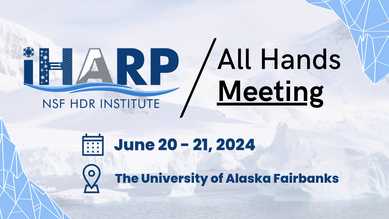
Thursday, June 20 and Friday, June 21, 2024
Wednesday, May 1, 2024 | 12p – 1p (est) | Dr. Chang-Tien Lu
Spatiotemporal Event Forecasting in Social Media
Speaker: Chang-Tien Lu is a Professor and National Capital Region Program Director in the Department of Computer Science, Curriculum Lead in the Innovation Campus, and Associate Director of the Sanghani Center for AI and Data Analytics at Virginia Tech.
Talk Abstract
Social media has become a popular data source as a surrogate for monitoring and detecting events. Analyzing social media (e.g., tweets) to reveal event information requires sophisticated techniques. Tweets are written in unstructured language and often contain typos, non-standard acronyms, and spam. In addition to the textual content, Twitter data form a heterogeneous information network where users, tweets, and hashtags have mutual relationships. These features pose technical challenges for designing event detection and forecasting methods. In this talk, I will present the design and implementation of a fully automated forecasting system for significant societal events using open-source data including tweets, blog posts, and news articles. I will describe the system architecture, individual models that leverage specific data sources, and a fusion engine that supports the trade-off between specific evaluation criteria. I will also demonstrate its superiority and capability to forecast significant societal happenings.
Tuesday, April 16, 2024 | 4p – 5p (est) | Dr. Chaopeng Shen
Differentiable modeling for continental- and global-scale water sciences
Speaker: Chaopeng Shen is an Associate Professor in Civil Engineering at The Pennsylvania State University.
Talk Abstract
Process-based modeling offers interpretability and physical consistency in many domains of geosciences but struggles to leverage large datasets efficiently. Machine-learning methods, especially deep networks, have strong predictive skills yet are unable to answer specific scientific questions or elucidate physical processes. A recently proposed genre of physics-informed machine learning, called “differentiable” models (https://t.co/qyuAzYPA6Y), connect neural networks (NNs) with process-based equations (priors) to benefit from the best of both NNs and process-based modeling paradigms. We propose that differentiable models are especially suitable for flood forecasting as well as continental- or global-scale water sciences. They can harvest information from big earth observations to produce state-of-the-art predictions that supercede purely data-driven models, enable physical interpretation naturally, extrapolate well (due to physical constraints) in space and time, and leverage progress in modern AI computing architecture and infrastructure. Differentiable models can also synergize with existing hydrologic models, learn from the lessons of the community and distinguish better priors. We demonstrate the power of differentiable modeling using computational examples in rainfall-runoff modeling, flood forecasting, river routing, as well applications in water-related domains such as ecosystem modeling and water quality modeling. Furthermore, we show how differentiable modeling can enable us to ask fundamental questions in water sciences, ecohydrology, and water quality.
Chaopeng Shen is an Associate Professor in Civil Engineering at The Pennsylvania State University. He received the Ph.D. degree in environmental engineering from Michigan State University, East Lansing, MI, USA, in 2009. His PhD research focused on computational hydrology and he developed the hydrologic model Process-based Adaptive Watershed Simulator (PAWS), which was later coupled to the community land model to study the interactions between hydrology and ecosystem. He was a Post-Doctoral Research Associate with the Lawrence Berkeley National Laboratory, Berkeley, CA, USA, from 2011 to 2012, working on high-performance computational geophysics. His recent efforts focused on harnessing the big data and machine learning (ML) opportunities in advancing hydrologic predictions and understanding. As an early advocate for machine learning in geosciences, he currently promotes differentiable modeling to integrate ML and physics for knowledge discovery and improved modeling of climate change impacts. He has written technical, editorial, review and collective opinion papers on hydrologic deep learning to call to attention the emerging opportunities for scientific advances. In addition, his research interests also include floodplain systems, scaling issues, process-based hydrologic modeling, and hydrologic data mining. He is currently an Editor of Journal of Geophysical Research – Machine Learning and Computation, and Associate Editor of the Water Resources Research and Chief Special Editor for Frontiers in AI: Water and AI.
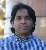
Wednesday, April 10, 2024 | 12p – 1p (est) | Dr. Raji Vatsavai
GeoAI for Social Good
Speaker: Dr. Raju Vatsavai is Chancellor’s Faculty Excellence Program Cluster Professor of Geospatial Analytics in the Department of Computer Science at North Carolina State University (NCSU).
This meeting was not recorded
Talk Abstract
Several decades of research have led to current advances in artificial intelligence (AI), specifically machine learning (ML) and deep learning (DL). These advancements hold promise for solving major challenges facing human society – from mitigating climate change to increasing food production, designing smart cities, and optimizing scarce resources. All these problems share a common thread: they are inherently rooted in space and time. Remote sensing data serves as a prime example of spatial big data. NASA recently collected its 10 millionth Landsat image. The coarse-resolution (30 m) Landsat collection itself surpasses a petabyte in size, while private satellite data producer MAXAR holds more than 125 petabytes of high-resolution data. Applications such as disease mapping, crop monitoring, and urban studies all rely on this data. We present recent advances in GeoAI that analyze these multimodal datasets and show their applications in various fields, including climate-smart agriculture, slum mapping, and critical infrastructure monitoring.
Raju Vatsavai is a Chancellor’s Faculty Excellence Program Cluster Professor of Geospatial Analytics in the Department of Computer Science at North Carolina State University (NCSU). Prior to joining NCSU, Raju served as the Lead Data Scientist for the Computational Sciences and Engineering Division (CSED) at the Oak Ridge National Laboratory (ORNL). His research focuses on the intersection of spatial and temporal big data management, machine learning, and high-performance computing. He has authored or co-authored over 100 peer-reviewed articles in conferences and journals. He has also edited two books on “Knowledge Discovery from Sensor Data.” He actively participates in the academic community, serving on program committees for leading international conferences such as ACM KDD, ACM SIGSPATIAL GIS, ECML/PKDD, SDM, CIKM, and IEEE BigData. He has further co-chaired several workshops, including ICDM/SSTDM, ICDM/KDCloud, ACM SIGSPATIAL BigSpatial, ACM/IEEE Supercomputing/BDAC, ACM KDD/LDMTA, ACM KDD/Sensor-KDD, and SIAM DM/ACS. Dr. Raju holds a M.S. and Ph.D. degrees in computer science from the University of Minnesota.
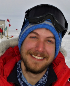
Tuesday, March 26, 2024 | 4p – 5p (est) | Dr. Nick Holschuh
Notes from the field: an overview of the motivation-for and approach-to ice penetrating radar data collection at Thwaites Glacier, West Antarctica
Speaker: Dr. Nick Holschuh is an Assistant Professor of Geology at Amherst College, iHARP Researcher
Talk Abstract
Changes to the ocean, in part driven by our emissions of CO2, have caused the acceleration of ice flow in West Antarctica. This enhanced discharge has resulted in a net mass loss from the Antarctic ice sheet, which contributes ~0.5 mm/a to global sea level rise. Thwaites Glacier, which sits in a deep marine basin in West Antarctica, is thought to be unstable in the face of ocean warming, but the rate and magnitude of ice loss there depends on unknown material properties of the glacier substrate. In his talk, Dr. Holschuh will discuss a geophysical campaign conducted on Thwaites Glacier during the 2023/24 Austral Summer, designed to constrain models of ice flow over the coming century. This will include an overview of ice penetrating radar, a discussion of the challenges in automated interpretation of ice penetrating radar data, and a description of the logistics-for and experience-of collecting data on one of Earth’s most rapidly changing glaciers.
Arctic OSSEs and Beyond
Speaker: Dr. Nikki Privé is an Associate Research Scientist at Morgan State University with GESTAR-II as a cooperative agreement employee with NASA Goddard Space Flight Center
Please click the button above to watch the presentation recording.
Talk Abstract
Observing System Simulation Experiments (OSSEs) are a type of digital twin framework used to simulate the potential impact of future observing networks on numerical weather prediction. This talk will give an overview of how data assimilation and OSSEs work, along with best practices for designing and conducting OSSEs. Available products and resources for building an OSSE framework will be described. Some challenges particular to developing OSSEs for polar regions will also be discussed.
Nikki Privé is an Associate Research Scientist at Morgan State University with GESTAR-II as a cooperative agreement employee with NASA Goddard Space Flight Center. She completed a B.S. in mechanical engineering at University of Maryland, College Park, followed by an M.S. and Sc.D. in meteorology at MIT. Nikki has worked on Observing System Simulation Experiments (OSSEs) for numerical weather prediction (NWP) both with the NOAA Earth Science Research Laboratory and at the Global Modeling and Assimilation Office (GMAO). Much of her research has focused on the roles of model and initial condition error in forecast skill, the calculation of observation impacts on numerical weather prediction, and the design of realistic OSSE frameworks.
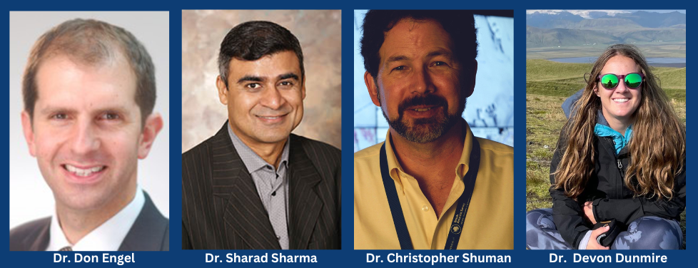
Tuesday, December 19, 2023 | 4p – 5p (est) | iHARP Researchers
iHARP 2nd Annual Fireside Chat
iHARP Researchers: Drs. Don Engel (UMBC), Sharad Sharma (UNT), Christopher Shuman (UMBC , NASA Goddard Space Flight Center) and Devon Dunmire (Uni. of Colorado Boulder)
This meeting was not recorded
Talk Abstract
Do you have an interest in Data, Polar, or Climate science and have questions for iHARP researchers? Now is your chance to ask questions and learn from the experts. You can submit a question in advance by completing the Google Form which can be found by clicking here. Please submit your question(s) by Monday, December 18th. Didn’t get your question in on time, don’t fret, we will take questions through out the chat.
Come, relax, and join us for an engaging informal conversation with leading scientists and researchers. This is your chance to ask the experts about their research.
Bring a warm drink and snacks, and cozy on up to the virtual fireside for our last 2023 Talk Tuesday event.
*Please note this event will not be recorded*
Tuesday, November 14, 2023 | 4p – 5p (est) | Dr. Xavier Soria Poma
Exploring low level image processing to boost middle and high-level computer vision tasks
Speaker: Dr. Xavier Soria, Research Scientist, Adjunct Professor at the National University of Chimborazo, and an Associate Researcher at the ESPOL Polytechnique University
Please click the button above to watch the presentation recording.
Talk Abstract
Since the advent of automatic image processing in the 60s of the 20th centuries, enormous advances have been made. Several fields have made use of computer vision and image processing tasks as a result of these breakthrough topics, from smile detection in smartphone’s cameras to space exploration in the vast universe. The first part of this presentation will introduce low-level image processing from the very beginning. I will briefly summarize the image edge detection task, highlighting current investigation and advances in this field. Secondly, I will present the contribution of my team in the edge detection domain; particularly, I will focus on how we see the problem and what advantages our proposal has over existing state-of-the-art models. Finally, I will show how edge detection boosts and improves work in different fields, such as breast cancer detection, calculation of ice sheet thickness from radar images and so on. All the models and datasets presented in the talk are freely available.
Dr. Xavier Soria is a research scientist working in image processing and computer vision. His current research focuses on advancing the fields of the image Edge Detection and thermal image Super Resolution driven by Artificial Intelligence (AI) models. He is interested in developing lightweight and efficient models. His contributions have transcended the initial domains and are now being applied to various high-level computer vision applications. Currently, he is an Adjunct Professor at the National University of Chimborazo and an Associate Researcher at the ESPOL Polytechnique University, both in Ecuador.
Tuesday, October 31, 2023 | 4p – 5p (est) | Dr. Donald Friedrich Boesch
Keeping Our Heads Above Water: Periodic Updating of Science-Based Sea-Level Rise Projections for Planning in Maryland
Speaker: Donald Friedrich Boesch, Ph.D. is President Emeritus and Professor Emeritus of the University of Maryland Center for Environmental Science (UMCES)
Please click the button above to watch the presentation recording.
Talk Abstract
As part of its efforts to address the climate crisis, the State of Maryland, with its 3,190 miles of shoreline and extensive low-lying coastal land, has, beginning in 2008, used sea-level rise projections in its planning. In 2015 the University of Maryland Center for Environmental Science was legally directed to update these projections at least every five years, with the latest projections produced in June 2023. Because it is important that projections have a solid scientific basis, we have used IPCC Assessments as the foundation, with the most recent projections relying on the Sixth Assessment Report (AR6). For the first time, the IPCC included Low Confidence projections that include unexpectedly rapid polar ice sheet loss, in addition to its Medium Confidence projections. Location specific, probabilistic projections based on the IPCC emissions pathway scenarios are provided through 2150 by NASA’s Sea Level Projection Tool. These projections include the effects of sterodynamic sea level and losses from water storage on land, glaciers, Greenland and Antarctica, in addition to local vertical land motion. We focused on a moderately mitigated emissions pathway (SSP2.4.5) based only on current commitments as the most plausible representation of the coming century, but also include estimates based on doubling of emissions by the end of this century (SSP3-7.0) and achieving the <2°C Paris Agreement goal (SSP1-2.6). These projections, along with extrapolations of tide gauge and satellite observations, indicate that relative sea-level rise will likely be between 0.3 m and 0.5 m by the middle of the century (from a 2005 base), beyond which the pathway of greenhouse gas emissions will have an increasingly significant influence, with polar ice sheet contributions growing if emissions are not reduced sufficient to meet the 2°C warming target. Under the current commitments only pathway, the best estimate of sea-level rise in Maryland in 2100 is 0.8 m, with the likely range of 0.6 to 1.1 m. Even with exceptionally rapid ice loss, it is very unlikely that it would exceed 1.5 m. Probability levels associated with these projections will be used as reference points for planning for both the natural and built environment.
Donald Friedrich Boesch, Ph.D. is President Emeritus and Professor Emeritus of the University of Maryland Center for Environmental Science (UMCES). From 1990 to 2017 he served as UMCES President; for the last nine of those years, he was also Vice Chancellor for Environmental Sustainability of the University System of Maryland.
Don Boesch received a B.S. in biology from Tulane University and a Ph.D. in oceanography from the College of William and Mary. Before coming to Maryland, he was a faculty member at William and Mary and the Louisiana State University. Don served on the Chesapeake Bay Cabinet under Governors Schafer, Glendening, Ehrlich, O’Malley and Hogan, and as a member of the Maryland Commission on Climate Change. He advised members of the General Assembly in crafting key legislation addressing the climate crisis, including the Greenhouse Gas Emissions Reduction Acts of 2009 and 2012 and the 2022 Climate Solutions Now Act. He continues to contribute to Maryland’s response to climate change, leading the recent update of Sea-Level Rise Projections for Maryland 2023.
Don has served on numerous committees and boards for U.S. federal agencies and for the National Academies of Sciences, Engineering and Medicine. He was a contributing author to the first and second U.S. National Climate Assessments. He served chair of the Academies’ Ocean Studies Board and was a contributing author to the America’s Climate Choices report. In 2010 he was appointed by President Obama as one of seven members of the National Commission on the BP Deepwater Oil Spill and the Future of Offshore Drilling.
Tuesday, October 10, 2023 | 4p – 5p (est) | Dr. Yiqun Xie
Harnessing AI Challenges for Earth Science Problems: From Space to Physics
Speaker: Dr. Yiqun Xie, Assistant Professor in Geospatial Information Science at the University of Maryland
Please click the button above to watch the presentation recording.
Talk Abstract
Advances in deep learning have continued to set new expectations for general tasks (e.g., computer vision, natural language processing) and bring new potential to harness geospatial big data for Earth Science problems. However, direct applications of deep learning often fall short due to challenges posed by geospatial data, including spatial heterogeneity/variability, sparse labels, etc. This talk will start with two general frameworks that explicitly tackle the challenges with: (1) A heterogeneity-aware framework that automatically recognize and handle spatial variability during model training; and (2) A physics-informed meta-learning framework that learns to select ensembles of physical models to assist training and reduce the need of labeled data. Then, the talk will show several examples of use-inspired AI for Earth Science, with applications in ICESat-2 height interpolation, global ecosystem model approximation, and label-free cloud masking. Finally, I will discuss our recent work on a coincidental data discovery platform to facilitate Arctic research.
Dr. Yiqun Xie is an Assistant Professor in Geospatial Information Science at the University of Maryland. He received his PhD in Computer Science at the University of Minnesota. One-size AI does not fit all. His research addresses challenges facing AI for spatial data, including heterogeneity, sparse training data, and locational bias. The spatial-aware AI techniques developed by his group have received multiple best paper awards from flagship conferences, including IEEE International Conference on Data Mining, SIAM International Conference on Data Mining, ACM SIGSPATIAL, and SSTD. His work was also highlighted by the Great Innovative Ideas at the Computing Community Consortium, Computing Research Association. His work is currently supported by the NSF, NASA, Google, etc.
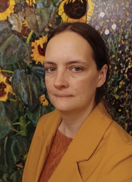
Tuesday, September 26, 2023 | 4p – 5p (est) | Dr. Sophie Goliber
Ghub: A science gateway for unifying ice sheet science and education
Speaker: Dr. Sophie Goliber, Postdoctroal researcher at University at Buffalo, Buffalo NY
Please click the button above to watch the presentation recording.
Talk Abstract
The urgency in reducing uncertainties of near-term sea level rise relies on improved modeling of ice sheet response to climate change. Predicting future ice sheet change requires a tremendous effort across a range of disciplines in ice sheet science, including expertise in observational data, paleoglaciology, numerical ice sheet modeling, and the widespread use of emerging methodologies for learning from the data. However, significant knowledge and disciplinary barriers make collaboration between data and model groups the exception rather than the norm. We seek to improve the efficiency in collaboration among traditionally disparate approaches to this problem. We present Ghub, a community-building scientific and educational cyberinfrastructure that includes models and data processing tools, online simulation, and collaboration support, available for use at theghub.org. Ghub enables collaboration between ice sheet scientific communities and acts as a host for the open-source tools that are becoming more common in the field of ice sheet science. We provide an overview of the Ghub framework, with examples of tools, tutorials, and educational content that are ready to use, and visions for extending these and other upcoming developments. These tools target a wide range of audiences, ranging from ice sheet modeling community efforts such as the Ice Sheet Model Intercomparison Project for CMIP6 (ISMIP6) to more specialized process-orientated investigations. We also outline the process for scientists to host their data and tools on the platform.
Tuesday, August 15, 2023 | 4p – 5p (est) | Dr. Stephen Guimond
The Dynamics of Megafire Smoke Plumes in Climate Models: Why a Converged Solution Matters for Physical Interpretations
Speaker: Dr. Stephen Guimond, Associate Research Professor UMBC/JCET, NASA/GSFC
Please click the button above to watch the presentation recording.
Talk Abstract
As the climate system warms, megafires have become more frequent with devastating effects. A byproduct of these events is the creation of smoke plumes that can rise into the stratosphere and spread across the globe where they reside for many months. To gain a deeper understanding of the plume dynamics, global climate simulations of a megafire were performed at a wide range of grid spacings from 2.0° down to 7 km, including a 7 km nonhydrostatic experiment. The analysis focuses on how the resolved dynamics affects the specification of the plume characteristics such as injection height and black carbon (BC) mass. Prior studies initialize the smoke plume at one or a few grid points and this is shown here to produce severely dissipative dynamics. In order to validate such simulations with observations, enhancements of the plume characteristics to offset the dissipation is necessary. Using a numerically converged simulation, sensitivity tests show that to approximate the observed stratospheric lifetime, a reduction in BC fraction by 50% is necessary for external mixtures. The vorticity dynamics of the plume is also analyzed with a Lagrangian budget to understand the mechanisms responsible for the evolution of a collocated anticyclonic vortex. The results can be distilled down into a simple conceptual model. As the plume rises, the air diverges at the top of the updraft where the largest concentrations of smoke are found. This divergence induces a dilution of the background cyclonic absolute vorticity producing an anticyclonic vortex. Vortex decay occurs from opposite arguments.
To read the related research article please click here.
Steve Guimond is an Associate Research Professor in the Department of Physics at the University of Maryland Baltimore County (UMBC) and scientist in the Mesoscale Atmospheric Processes Laboratory at NASA Goddard Space Flight Center (GSFC). His research portfolio consists of: (1)Remote sensing with a focus on airborne radar including designing algorithms for computing geophysical variables such as winds, latent heat & precipitation and (2)Geophysical fluid dynamics with a focus on hurricanes, convection, turbulence & computational methods. His most recent work focuses on wildfire smoke plume modeling with the NASA GEOS system funded by the Department of Energy/Los Alamos National Laboratory.
Tuesday, June 20, 2023 | 4p – 5p (est) | Maria Esteva
Share or Perish: Open Science, Open Data and What it All Means to iHARP Researchers
Speaker: Maria Esteva, Research Scientist at the University of Texas at Austin, Lead Data Curatorin DesignSafe at TACC, iHARP Senior Researcher
Talk Abstract
This talk will introduce open data theory and practices including recent requirements for federally funded projects generating models and data. We will discuss the reasons why curating data is fundamental for research reproducibility and reliability, as well as how it contributes to multiply the impact of research. What curation entails in terms of researchers’ efforts and research infrastructure requirements will also be presented. In particular, we will brainstorm about how all of this is pertinent to iHARP.
Maria Esteva has a PhD in Information Science and is a Research Scientist at the University of Texas at Austin. Her research focuses on modeling large-scale data derived from diverse research methods and domains as interactive curation and publication pipelines and measuring the impact of data publications and reuse. Maria works at the Texas Advanced Computing Center where she is the lead data curator in DesignSafe (https://designsafe.org), an NSF-funded platform for management, analysis, and publication of natural hazards and social science data, Her work in the NSF GCR Community-Embedded Robotics: Understanding Sociotechnical Interactions with Long Term Autonomous Deployments involves building a convergent data model that allows transdisciplinary collaborative analysis of multiple datasets collected during the research project
Tuesday, May 23, 2023 | 4p – 5p (est) | Edward Boyda
Active learning on the ice sheet: Classroom mapping of meltwater lakes and cracks in satellite imagery
Speaker: Edward Boyda, Physicist and a co-founder of Earthrise Media and Kim Young, Classroom Teacher
Talk Abstract
Earthrise Education creates project-based learning curricula for middle- and high-school classrooms, with elements of remote sensing data science and environmental and environmental justice themes. Projects invite students to engage in real-world investigative and mapping activities using satellite imagery, generating data for journalist, NGO, or scientific partners.
The current project, run in partnership with iHARP, takes on climate change and the cryosphere. Students delineate meltwater lakes, cracks, and moulins in Planet Labs SkySat imagery over the Greenland ice sheet, for use as training data for future machine-learned systems. We first present some background and results from the initiative. As of writing, 650 students from 9 schools have participated, creating 23,909 labeled features. A teacher and students will relate their experience with the project, describing high student engagement in contributing to the iHARP scientific program.
Edward Boyda is a physicist and a co-founder of Earthrise Media, where he runs satellite-based investigations for environmental and human rights reporting. He helped build the neural network pipelines behind Amazon Mining Watch and Global Plastics Watch and contributed data reporting to dozens of stories in the international news media. He is a research member of the AI-Journalism Resource Center at OsloMet University.
Previously, Edward was an Associate Professor of Physics at Saint Mary’s College of California and a researcher in quantum computing at the BAER Institute at NASA Ames Research Center.
Wednesday, May 17, 2023 | 12p – 1p (est) | Dr. Vipin Kumar
Knowledge-Guided Machine Learning: A New Framework for Accelerating Scientific Discovery and Addressing Global Environmental Challenges
Speaker: Dr. Vipin Kumar
Regents Professor and William Norris Endowed Chair, CSE
This is a hybrid event hosted by UMBC Department of Information Systems as a part of their Distinguished Guest Speaker Series
In-person location: UMBC ITE 459
Talk Abstract:
Process-based models of dynamical systems are often used to study engineering and environmental systems. Despite their extensive use, these models have several well-known limitations due to incomplete or inaccurate representations of the physical processes being modeled. There is a tremendous opportunity to systematically advance modeling in these domains by using state-of-the-art machine learning (ML) methods that have already revolutionized computer vision and language translation. However, capturing this opportunity is contingent on a paradigm shift in data-intensive scientific discovery since the “black box” use of ML often leads to serious false discoveries in scientific applications. Because the hypothesis space of scientific applications is often complex and exponentially large, an uninformed data-driven search can easily select a highly complex model that is neither generalizable nor physically interpretable, resulting in the discovery of spurious relationships, predictors, and patterns. This problem becomes worse when there is a scarcity of labeled samples, which is quite common in science and engineering domains. This talk makes the case that in real-world systems that are governed by physical processes, there is an opportunity to take advantage of fundamental physical principles to inform the search of a physically meaningful and accurate ML model. While this talk will illustrate the potential of the knowledge-guided machine learning (KGML) paradigm in the context of environmental problems (e.g., Fresh water science, Hydrology, Agronomy), the paradigm has the potential to greatly advance the pace of discovery in a diverse set of discipline where mechanistic models are used, e.g., climate science, weather forecasting, and pandemic management.
Vipin Kumar is a Regents Professor at the University of Minnesota, where he holds the William Norris Endowed Chair in the Department of Computer Science and Engineering. Kumar received the B.E. degree in Electronics & Communication Engineering from Indian Institute of Technology Roorkee (formerly, University of Roorkee), India, in 1977, the M.E. degree in Electronics Engineering from Philips International Institute, Eindhoven, Netherlands, in 1979, and the Ph.D. degree in Computer Science from University of Maryland, College Park, in 1982. He also served as the Head of the Computer Science and Engineering Department from 2005 to 2015 and the Director of Army High Performance Computing Research Center (AHPCRC) from 1998 to 2005. Kumar’s research spans data mining, high-performance computing, and their applications in Climate/Ecosystems and health care. His research has resulted in the development of the concept of isoefficiency metric for evaluating the scalability of parallel algorithms, as well as highly efficient parallel algorithms and software for sparse matrix factorization (PSPASES) and graph partitioning (METIS, ParMetis, hMetis). He has authored over 300 research articles, and has coedited or coauthored 10 books including two text books “Introduction to Parallel Computing” and “Introduction to Data Mining”, that are used world-wide and have been translated into many languages. Kumar’s current major research focus is on bringing the power of big data and machine learning to understand the impact of human induced changes on the Earth and its environment. Kumar served as the Lead PI of a 5-year, $10 Million project, “Understanding Climate Change – A Data Driven Approach”, funded by the NSF’s Expeditions in Computing program that is aimed at pushing the boundaries of computer science research.
Kumar has served as chair/co-chair for many international conferences in the area of data mining, big data, and high performance computing, including 25th SIGKDD Conference on Knowledge Discovery and Data Mining (KDD 2019), 2015 IEEE International Conference on Big Data, IEEE International Conference on Data Mining (2002), and International Parallel and Distributed Processing Symposium (2001). Kumar co-founded SIAM International Conference on Data Mining and served as a founding co-editor-in-chief of Journal of Statistical Analysis and Data Mining (an official journal of the American Statistical Association). Currently, Kumar serves on the steering committees of the SIAM International Conference on Data Mining and the IEEE International Conference on Data Mining, and is series editor for the Data Mining and Knowledge Discovery Book Series published by CRC Press/Chapman Hall.
Kumar has been elected a Fellow of the American Association for Advancement for Science (AAAS), Association for Computing Machinery (ACM), Institute of Electrical and Electronics Engineers (IEEE), and Society for Industrial and Applied Mathematics (SIAM). He received the Distinguished Alumnus Award from the Indian Institute of Technology (IIT) Roorkee (2013), the Distinguished Alumnus Award from the Computer Science Department, University of Maryland College Park (2009), and IEEE Computer Society’s Technical Achievement Award (2005). Kumar’s foundational research in data mining and high performance computing has been honored by the ACM SIGKDD 2012 Innovation Award, which is the highest award for technical excellence in the field of Knowledge Discovery and Data Mining (KDD), the 2016 IEEE Computer Society Sidney Fernbach Award, one of IEEE Computer Society’s highest awards in high-performance computing, and Test-of-time award from 2021 Supercomputing conference (SC21)
Tuesday, April 18, 2023 | 4p – 5p (est) | Dr. Lauren Andrews
PolarMERRA: A Polar-Focused Global Reanalysis Project for Scientific and Stakeholder Needs
Talk Abstract:
The adequate modeling of physical processes in the Arctic and Antarctic is vital for developing prediction capabilities and for obtaining an understanding of rapidly evolving polar conditions, including their potential global impacts. These processes are often poorly represented in global models and reanalyses, owing to a legacy modeling focus on midlatitude processes, as well as a scarcity of observations needed for model development in polar regions. The polarMERRA initiative, a joint effort between NASA’s Cryospheric Sciences and Modeling and Prediction programs, seeks to improve the representation of cryospheric and polar atmospheric processes and to develop an open-source framework for a quantitatively evaluation of polar-relevant variables against current and future satellite and in-situ observations, models, and reanalyses.
Here, we evaluate the impacts of spatial resolution and modifications to sea ice, ice sheet, and atmospheric parameterizations on the representation of high latitude conditions by using a quantitative scorecard approach that leverages NASA’s extensive satellite record. Investigations are conducted using the NASA Goddard Earth Observing System model (GEOS) and its data assimilation system (GEOS DAS). Through a quantitative identification of process deficiencies, bias reductions in key surface variables, including temperature and precipitation over cryospheric surfaces, may be achieved. The polarMERRA project additionally seeks to identify additional data sources for use in the GEOS DAS, and to incorporate data and parameterization improvements into future model and reanalysis products for scientific and stakeholder use.
Dr. Lauren Andrews is an earth scientist with the Global Modeling and Assimilation Office (GMAO) at NASA Goddard Space Flight Center (GSFC). Her research focuses on understanding the role of the cryosphere in the Earth system, including how glacial meltwater can alter the dynamic response of ice sheets and glaciers and how the representation of cryospheric processes, including snow and sea ice, can impact sub-seasonal to seasonal forecasting. She is a member of the GMAO Subseasonal-to-Seasonal Prediction Team, and she leads the PolarMERRA Reanalysis Project, a joint effort between GMAO and GSFC Cryospheric Sciences Lab, to produce a high-resolution atmospheric reanalysis focused on the representation of polar regions.
Wednesday, April 19, 2023 | 12p – 1p (est) | Professors Lee W. Cooper and Jacqueline M. Grebmeier
Co-presented by iHARP and UMBC Department of Information Systems
Key Drivers of Marine Ecosystem Change under Climate Warming: Results from the Distributed Biological Observatory in the Pacific Arctic
Talk Abstract:
In the Pacific Arctic, warming seawater and reduced sea ice have changed the state of the marine ecosystem in the northern Bering and Chukchi Seas. Changes in upper-ocean hydrography, primary productivity, pelagic-benthic coupling and carbon cycling, and lower and upper trophic levels are being evaluated through the Distributed Biological Observatory (DBO). This cooperative venture was initiated in 2010 and includes international coordination of research cruises. The DBO emphasizes standardized sampling on set transect lines to measure ecosystem status and environmental trends. Continuous data are also obtained through moorings, satellite observations, and autonomous sampling. DBO sampling has revealed that seasonal and interannual hydrographic changes are driving shifts in species composition, distribution and abundance, with northward range expansions into Arctic waters for some temperate species and negative impacts for some cryophillic species. The seasonal timing of phytoplankton growth influences organic materials exported to epi- and infaunal benthic animals, which are important prey for benthic-feeding marine mammals and seabirds. Sediments are also indicators of changing organic carbon deposition providing seasonal and interannual records of water column biological events. This presentation will highlight findings from studies of biological change, the use of sediment chemistry to understand ecosystem status, and key physical drivers for these observed changes.
Lee Cooper is a Professor at the Chesapeake Biological Laboratory of the University of Maryland Center for Environmental Science. He received his Ph.D. in Oceanography from the University of Alaska Fairbanks in 1987 following undergraduate and graduate work at the University of California, Santa Cruz and the University of Washington. He has been involved in long-term studies of biological communities on the seafloor of the Bering and Chukchi Seas and how they are responding to changes in seasonal sea ice and other climatically-driven variables. His analytical expertise includes measurements of stable and radioactive isotopes, including organic and inorganic materials, such as soils and sediments, atmospheric gasses, plant and animal tissues, and natural waters. He served internationally as the chair of the Marine Working Group of the International Arctic Science Committee, a non-governmental entity that helps to coordinate arctic research among 24 nation members. He is the section editor for Biogeochemistry for the journal PLOS One and the lead author or co-author of approximately 160 peer-reviewed publications, including high-impact journals such as Science, Nature, Proceedings of the National Academy of Science, Ecology, Marine Ecology Progress Series and Geophysical Research Letters.
Jackie Grebmeier is a Professor at the Chesapeake Biological Laboratory of the University of Maryland Center for Environmental Science. Her oceanographic research interests are related to pelagic-benthic coupling, benthic carbon cycling, and benthic faunal population structure in the marine environment. Her field research program in the Arctic has focused on such topics as understanding how water column processes influence biological productivity in Arctic waters and sediments, how materials are exchanged between the sea bed and overlying waters, and documenting longer-term trends in ecosystem health of Arctic continental shelves. Research projects have included analyses of the importance of benthic organisms to higher levels of the Arctic food web, including walrus, gray whale, and diving sea ducks, and studies of radionuclide distributions in sediments and within the water column in the Arctic as a whole. She is a Fellow of the American Association for the Advancement of Science, a recipient of the International Arctic Science Committee Medal, and she has also served on a number of advisory and review committees to the U.S. National Academy of Sciences, Polar Research Board, National Science Foundation (NSF), National Oceanographic and Atmospheric Administration (NOAA), and Fish and Wildlife Service, and she was appointed to the US Arctic Research Commission by President Clinton. She also served as project director and chief scientist for a National Science Foundation and Office of Naval Research supported field research program in the Beaufort and Chukchi Seas that investigated the exchange of materials between the continental shelves and the deeper Arctic basin in the context of global change (Shelf-Basin Interactions Phase II, 2001-2007), as well as a number of other interdisciplinary projects in the Arctic. A current effort is the internationally coordinated Distributed Biological Observatory in the Arctic that is supported by a number of US agencies, as well as science agencies in Canada, Korea, Japan and China.
Tuesday, March 14, 2023 | 4p – 5p (est) | Dr. Guangqing Chi
POLARIS: The Pursuing Opportunities for Long-term Arctic Resilience for Infrastructure and Society
Speaker: Dr. Guangqing Chi
Professor of Rural Sociology and Demography and Director of the Computational and Spatial Analysis Core at The Pennsylvania State University
Alaskan coastal Indigenous communities face severe, urgent, and complex social and infrastructural challenges resulting from environmental changes. However, the magnitude and significance of impacts are unclear; as is how local communities will respond to resulting disruptions and disasters. This POLARIS project investigates how interconnected environmental stressors and infrastructure disruptions are affecting coastal Alaskan communities and identifies important social, environmental, infrastructural, and institutional assets to help them adapt and become more resilient to climate-related changes. The POLARIS project has identified three convergent and interconnected research pillars to help communities adapt: environmental hotspots of disruption to communities and infrastructure, food in complex adaptive systems, and migration and community relocation.
The ultimate goal of this integrated research project is to enable communities to become more resilient with both stronger societies, civic culture, and improved infrastructure needed as the new Arctic continues to emerge. In addition to introducing the POLARIS project, this talk will highlight one of its studies—the COVID-19 pandemic impacts on fishing communities in Alaska.
Bristol Bay in Alaska is home to the world’s largest commercial salmon fishery. During an average fishing season, the population of the Bristol Bay region more than doubles as thousands of workers from out of state converge on the fishery. In the months leading up to 2020 commercial fishery opening, as the COVID-19 pandemic exploded worldwide, great uncertainty existed about the health risks of opening the fishery. Bristol Bay residents had not yet experienced any cases of COVID-19, yet the livelihoods of most were closely tied to the commercial fishery opening. To better understand how COVID-19 risk perceptions affected decisions to participate in the fishery, we administered an online survey to community members and fishery participants. We collected standard socioeconomic data and posed questions to gauge risk perceptions related to COVID-19. We find that COVID-19 risk perceptions vary across race/ethnic groups by residency and income. People with below median income who are members of minority groups—notably, non-resident Hispanic workers and resident Alaska Native respondents—reported the highest risk perceptions related to COVID-19. It is also the same demographic group who had the highest participation in the fishing season. This study highlights the important linkages among risk perceptions, socioeconomic characteristics, and employment decisions during an infectious disease outbreak.
Guangqing Chi is a Professor of Rural Sociology and Demography and Director of the Computational and Spatial Analysis Core at The Pennsylvania State University. His research seeks to understand the interactions between human populations and the built and natural environments and to identify important social, environmental, infrastructural, and institutional assets to help vulnerable populations adapt and become resilient to environmental changes. His research has been supported by more than $50 million grants, including the $3 million multi-institutional transdisciplinary POLARIS project (https://arcticpolaris.org) funded by the National Science Foundation, to investigate environmental migration and food security in response to climate change. He has published over 140 publications including more than 80 peer-reviewed journal articles, contributing to foundational advances in environmental demography and population-infrastructure nexus. Chi’s work has led to innovative methods for identifying and measuring human–environment hotspots relating to land developability, population stress, wildfire–population corridors, ecosystems–development stress areas, rural land vulnerable to abandonment, critical riparian zones, and urban areas with high heat risks. He also led the development of spatiotemporal regression methods and applied them in his research on migration, poverty, and fertility. Chi is lead author of the textbook Spatial Regression Models for the Social Sciences (SAGE 2019). His work in applied demography has led to state-of-the-art spatial methods for population forecasting. His current methodological focus is to build an infrastructure for collecting, integrating, and analyzing multi-dimensional and multi-scale data, including big social data (60+ TB; Twitter, Facebook, mobile phones, credit cards, web scraping). He currently leads an NSF project to study the (mis)representativeness of Twitter data and to develop weights to generalize the data, which will create myriad opportunities for social scientists to take advantage of rich social media data. His work is often collaborative and transdisciplinary, aiming to create significant impacts through the integration of research, education, community engagement and outreach, and sometimes international collaboration. For more information, refer to: https://theedenresearch.org/
Tuesday, February 21, 2023 | 4p – 5p (est) | Dr. Aneesh Subramanian
Exploring physical and Machine Learning approaches for stochastic modeling and ensemble prediction of weather and climate
Speaker: Dr. Aneesh Subramanian
Assistant Professor of Atmospheric and Oceanic Sciences at CU Boulder, and iHARP Co-PI
Abstract:
Convection and cloud processes play a key role in the dynamics of the atmosphere just as mesoscale turbulence and deep convection do in ocean dynamics and ice-shelf processes do in ice sheet dynamics. Yet, even today our shortcomings in parameterizing these subgrid scale processes in global climate models (GCMs) are limiting our ability to simulate and understand the climate and weather of the planet. Recent innovative ideas on convection parameterization such as super-parameterization (embedding cloud-resolving models within the GCM grid), stochastic-parameterization or machine learning emulation in weather and climate models have helped improve its representation of the climate and weather systems. These approaches in parameterization have emerged as new paths forward and complement the conventional approaches rather than replace them. We study the impact of these approaches on forecasts from weather to climate timescales. Results from studies using stochastic parameterization in ensemble forecasting systems as well as machine learning approaches for causal discovery, feature detection and ensemble prediction post-processing will be presented. In addition, results from using machine learning approaches for stochastic parameterization of subgrid-scale variability in an idealized system will be presented to motivate future studies in this direction with the weather and climate forecasting systems. This has implications on improving conventional parameterization using hybrid approaches as we await the exascale computing systems of the future to resolve key processes in climate models.
Dr. Aneesh Subramanian, Assistant Professor of Atmospheric and Oceanic Sciences at CU Boulder, as well as iHARP Co-PI. He is also a visiting scientist at the Center for Western Weather and Water Extremes at Scripps Institution of Oceanography, UC San Diego, and a visiting scholar in the Predictability of Weather and Climate group in the Physics Dept. at the University of Oxford. Dr. Subramanian brings expertise in climate dynamics and recent experience using machine learning techniques for varied climate science applications.
In Person Event
- January 9 & 10, 2023 — iHARP All Hands Meeting/ Conference.
- Location: UMBC, Baltimore, Maryland
December 20, 2022 | 4p – 5p | Career Fireside Chat
Career Fire Side Chat with iHARP Research Members
About: Do you have an interest in Data, Polar, or Climate science and have questions for our researchers? Join us for an informal conversation with leading scientists and researchers. This is your chance to ask experts in the field questions about their work.
Do you have a question you like to submit? Please submit your question(s) by Monday, December 19th. Forgot to hit submit, don’t fret! You can always ask live or submit a question to the chat.
Bring a warm drink and snacks, and join us by the virtual fireside for our last 2022 seminar.
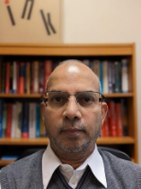
Wednesday, November 16, 2022 | 12p – 1p | Dr. Dr. Abdullah Mueen
Mining and Learning from Big Time Series Data
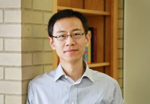
A journey in science research, education, and cooperative center administration
Speaker: Dr. Belay Demoz
Professor and Director of JCET
The above button will take you to the Talk Tuesday Recording Page.
Belay holds a doctoral degree in Atmospheric Physics from the University of Nevada and Desert Research Institute in Reno, Nevada. Prior to joining UMBC/JCET, he was Professor of Physics at the Department of Physics and Astronomy at Howard University, where he was Director of Graduate Studies for the Physics Department and also one of the Principal PI’s at the Beltsville Research Campus. Before joining academia, Dr. Demoz has worked for the private industry as a NASA contractor, followed by some time as a Civil Servant at NASA/GSFC in the Mesoscale Dynamics Branch. His research interests include mesoscale observation and instrumentation in atmospheric physics and climate as well as atmospheric science influence in climate policy. He has chaired the Committee for Atmospheric LIDAR Application Studies (CLAS) for the American Meteorological Society; is a member of the Atmospheric Observation Panel for Climate (AOPC) Working Group on GRUAN (WG-GRUAN); and has served as Associate Editor for the Journal of Geophysical Research, the web magazine Earthzine (http://www.earthzine.org/) and many other editorial boards. He has organized national and international conferences and workshops and serves in a number of working groups and international organization and also serves as an adjunct Professor at University of Utah. He is also active in organizing national and international research field observations (e.g. WAVES 2007, IHOP2002, PECAN 2015 for example). He is the current Director of the Joint Center for Earth Systems Technology (JCET: http://jcet.umbc.edu).
Seminar: Zachariæ Isstrøm, North East Greenland, Ice Shelf Changes From Landsat – 1975 to 2021 and Landsat@50
Zachariæ Isstrøm, North East Greenland, Ice Shelf Changes From Landsat – 1975 to 2021 and Landsat@50
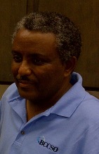
Speaker: Dr. Christopher Shuman
When: October 18th, 2022 (4-5 PM EST)
The above button will take you to the Talk Tuesday Recording Page.
Speaker: Dr. Christopher Shuman
When: October 18th, 2022 (4-5 PM EST)
Please click the button above to navigate to the meeting link. If you have any questions, please email iHARP@umbc.edu.
Dr. Christopher A. Shuman is a Research Scientist within the Cryospheric Sciences Laboratory at NASA Goddard Space Flight Center (GSFC). He has been employed by the University of Maryland, Baltimore County’s (UMBC’s) Joint Center for Earth Systems Technology (JCET) since 2011, now Goddard Earth Sciences Technology and Research (GESTAR) II. Before joining JCET, he was with UMBC’s Goddard Earth Sciences & Technology Center (GEST) for four years. In 2014, he became affiliated with UMBC’s Geography and Environmental Systems Department as an Research Associate Professor.
Seminar: What is special about Geo-AI and Spatial data science ?
Speaker: Dr. Shashi Shakhar
When: Sept 13th, 2022 (4-5 PM EST)
Abstract: Rise of spatial big data (e.g., trajectories, remote-sensing) is fueling growth of Geo-AI (e.g., geo-imagery analysis automation) for making previously unimaginable maps, answering trail-blazing geo-content based queries, and understanding spatiotemporal patterns of our lives, etc. Applications span from apps for navigation, ride-sharing, and delivery to monitoring global crops, climate change, diseases, and smart cities to understanding cellular or urban patterns of life.
However, one-size-fit-all machine learning performs poorly (e.g., salt-n-pepper noise, inaccuracy) due to spatial autocorrelation and variability, which violate the common i.i.d. assumption (i.e. data samples are generated independently and from identical distribution). Furthermore, high cost of spurious patterns requires guardrails such as noise tolerance, and modeling of spatial concepts (e.g., polygons) and implicit relationships (e.g., distance, inside). In addition, methods discretizing continuous space face the modifiable areal unit problem (e.g., gerrrymandering).
Thus, the talk suggests spatial data science approaches and describes methods for spatial classification and prediction (e.g., spatial auto-regression, spatial decision trees, spatial variability aware neural networks) along with techniques for discovering patterns such as noise-robust hotspots (e.g., SaTScan, linear, arbitrary shapes), interactions (e.g., co-locations, tele-connections ), spatial outliers, and their spatio-temporal counterparts (e.g., cascade , mixed-drove co-occurrence ). It concludes by calling for inclusion of spatial perspectives in data science courses and curricula.
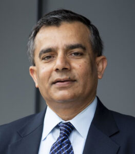
Shashi Shekhar is a leading scholar of spatial data science, spatial computing and Geographic Information Science (GIS). Currently, he is a Mcknight Distinguished University Professor and a University Distinguished Teaching Professor at the University of Minnesota (UMN). Recognitions include IEEE-CS Technical Achievement Award, UCGIS Education Award, IEEE Fellow, AAAS Fellow. He was also named a key difference-maker for the field of GIS by the most popular GIS textbook.
He is serving on the Computing Research Association (CRA) board (2016-22), a co-chair for the CRA Snowbird conference (2022), a co-Editor-in-Chief of Geo-Informatica (Springer), and a program co-chair for ACM SIGSpatial Intl. Conference (2022). Earlier, he served as the President of the University Consortium for GIS (UCGIS), and on many National Academies’ committees including Geo-targeted Disaster Alerts and Warning (2013), Future Workforce for GEOINT (2011), Mapping Sciences (2004-2009) and Priorities for GEOINT Research (2004-2005).
In 1990s, Shashi’s research developed roadmap storage and routing methods, which have revolutionized outdoor navigation. His evacuation route planning algorithms were used for homeland security and received many recognitions including the UMN CTS Award for significant impact on transportation. His recent research is analyzing spatial big data to recommend eco-routes to reduce emissions and energy use. He also pioneered spatial data mining research area via pattern families (e.g. colocation), keynotes, surveys and workshops.
Shashi’s 350+ publications include a popular textbook on Spatial Databases (Prentice Hall, 2003), an authoritative Encyclopedia of GIS (Springer, 2017) and a spatial computing book for broad audience. Many of Shashi’s 100 advisees are serving in leadership positions and have received prestigious recognitions such as the Presidential Early Career Awards for Scientists and Engineers and NSF CAREER.
Shashi received a Ph.D. degree in Computer Science from the University of California (Berkeley, CA). More details are available from http://www.cs.umn.edu/~shekhar.
Seminar: Overview of Texas Advanced Computing Center Systems and Services (TACC)
Speaker: Dr. Tim Cockerill
When: August 30th, 2022 (4-5 PM EST)
Dr. Cockerrill will discuss TACC’s computing research environment and how iHARP users can work with TACC’s resources.
Bio: Tim Cockerill is TACC’s Director of User Services. He oversees the allocations process by which computing time and storage is awarded on TACC’s HPC systems. The User Services team is also responsible for user account management, training, and user guides. Tim also currently serves as the DesignSafe Deputy Project Director, providing a web-based platform supporting natural hazards research. Tim is co-PI on two NSF CC* awards providing training and research support for underserved/under-resourced universities and community colleges. Tim joined TACC in January, 2014, as the Director of Center Programs responsible for program and project management across the Center’s portfolio of awards. Prior to joining TACC, he was the Associate Project Director for XSEDE and the TeraGrid Project Manager. Before entering the world of high performance computing in 2003, Tim spent 10 years working in startup companies aligned with his research interests in gallium arsenide materials and semiconductor lasers. Prior to that, Tim earned his B.S., M.S., and Ph.D. degrees from the University of Illinois at Urbana-Champaign and was a Visiting Assistant Professor in the Electrical and Computer Engineering Department
Seminar: Possibilities and Resources for Machine Learning at the Texas Advanced Computing Center (TACC)
Speaker: Dr. Zhao Zhang
When: August 23rd, 2022 (4-5 PM EST)
Dr. Zhang will discuss ML projects at TACC and share with the iHARP community on how to work with the available resources for ML at TACC.
Bio: Dr. Zhao Zhang is a computer scientist and the manager of the scalable computing intelligence group at Texas Advanced Computing Center (TACC). Prior to joining TACC in 2016, he was a postdoc researcher at AMPLab, UC Berkeley and the data science fellow at the Berkeley Institute for Data Science. Dr. Zhang received his Ph.D from the Department of Computer Science at UChicago in 2014. Dr. Zhang has extensive experience in high performance computing (HPC) and big data systems. His recent research focus is the fusion of HPC and deep learning (DL) with a wide range of topics of optimization algorithm, I/O, architecture, and domain applications. His research has been funded by NSF. He is the TACC PI of the NSF ICICLE AI Institute.
Workshop: IS-GEO and iHARP are pleased to announce a virtual workshop on Model-based Reasoning.
Event Information
- Dates: August 15-19, 2022
- Location: Virtual (Zoom)
- Registration Link: https://forms.gle/R1ZXLdEn2WDgTANR7
- Schedule and Event Site: https://is-geo.github.io/ISGEO-22/
Seminar: Ice sheet surface processes 101
Speaker: Dr. Jan Lenaerts
When: 19th July 2022 (4-5 pm EST)
Jan Lenaerts (Dept of Atmospheric and Oceanic Sciences, University of Colorado Boulder)
https://www.colorado.edu/lab/icesheetclimate/jan-lenaerts-hehim
Abstract: In this seminar, Jan will talk through the most fundamental physical processes affecting the surface of the Greenland and Antarctic ice sheets. He will present how the ice sheet surface changes as a result of the atmosphere, the surface characteristics, and subsurface properties, and what these surface changes look like in observations and models. Jan will also discuss why, when, and where surface processes are relevant for ice sheet mass loss and sea level rise, and answer any questions that any of you might have. Please send him your questions beforehand!
Pre-reading and pre-viewing for the talk:
https://agupubs.onlinelibrary.wiley.com/doi/full/10.1029/2018RG000622
https://vimeo.com/347002983
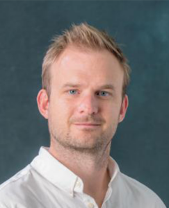
Bio:
Jan is principal investigator and leader of the Ice Sheets and Climate lab, and has started as an Assistant Professor in the Department of Atmospheric and Oceanic Sciences in August 2017. He is an ice sheet and climate scientist with a specific interest in polar climate, snow-atmosphere and ice-ocean interactions on meso- to global scale. Jan’s main tools are climate and snow models, evaluated with remote sensing and in-situ climate observations. He received his PhD cum laude in Polar Meteorology at Utrecht University, The Netherlands in 2013. He acts as co-chair of the Land Ice Working Group of CESM, is editorial board member of Nature Communications Earth & Environment, and member of the NASA Sea Level Change Team and ICESat-2 Science team.
In his free time, Jan loves road and mountain bike riding, running, hiking, camping and snowboarding.
Seminar: Climate Resilience Data Challenge: A report
Speakers:
Dr. Emilie Ramsahai, University of the West Indies Five Islands Campus in Antigua,
Dr. Ilenius Ildephonce,University of the West Indies Five Islands Campus in Antigua
Dr. Letetia Addison, University of the West Indies (UWI), St. Augustine Campus
Mr. Kevan Rajaram, Republic Bank Limited
Dr. Karen Chen, University of Maryland Baltimore County
When: 21st June 2022 (4-5 pm EST)
Abstract:
In this talk, we will present work from the two winning teams for the 2022 Climate Resilience Data Challenge, a component of the 6th Growth and Resilience Dialogue organized by the Eastern Caribbean Central Bank (ECCB) in collaboration with the OECS Commission, The World Bank, and the University of the West Indies. In the first part of the talk, we will discuss the OECS Disaster Risk Smart Classification (DRSmC) Prototype for emergency responders, which is comprised of a classifier for predicting the country-level risk of flooding, augmented with NLP-enabled analytics for social medial feeds. The second part of the talk will focus on a “usable science” analytics framework connecting polar-region ice melting, sea-level change, climate analytics, and tourism sustainability for Eastern Caribbean Countries.
Semniar: Emerging Hydrologic Feedbacks on the Greenland Ice Sheet: Recent Discoveries and Unanswered Questions
Emerging Hydrologic Feedbacks on the Greenland Ice Sheet: Recent Discoveries and Unanswered Questions
Speaker: Dr. Michael MacFerrin
When: May 24, 2022 (4-5 PM EST)
The above button will take you to the Talk Tuesday Recording Page.
Speaker: Dr. Michael MacFerrin, University of Colorado in Boulder
When: 24th May 2022 (4-5 pm EST)
Abstract: As Arctic climate warms, the Greenland ice sheet has undergone enormous hydrologic changes over the past few decades. Recent advances in satellite, airborne, and field-based observations are rewriting previous assumptions about how we believe the Greenland ice sheet behaves in a warming climate while also raising questions about its future potential for melt. Join glaciologist Mike MacFerrin as he reviews what glaciologists have recently been learning about how the Greenland ice sheet responds to a rapidly changing climate, the implications for interpreting its past, and the open questions being explored today about what the future holds for our northern ice sheet.
Bio: Dr. Michael MacFerrin is a research scientist at the University of Colorado Boulder and the NOAA Centers for Environmental Information. Using data from six field campaigns to Greenland, MacFerrin’s research has helped to discover and confirm recent rapid changes occuring in the subsurface stratigraphy of Greenland’s ice sheet, develop remote sensing tools to map those changes across the island, and use climate models to project the impacts of Greenland’s future runoff on 21st-century global sea-level rise.
When: 3rd May 2022 (12-3 pm EST)
iHARP Team Strategic meeting
When: 16 Feb 2022 (3-5 pm EST)
Dr. Rajasheree TriDatta: Antarctica to Greenland from the Atmosphere to the Bed
Drs. Jianwu Wang and Vandana Janeja: Data Science terms and patterns
Breakout sessions by focus areas; Breakout report backs